
This page on our self-instruction website emphasizes the significance of interpreting the 360° notation as a full circle, particularly in the worksheet dedicated to calculating intercept and azimuth.

You can find more information on this site: www.scienceabc.com
The main purpose of this website is to explain how to find your position at sea using a sextant and the sun. Of course, this involves understanding the 360° formulas and the use of the sexagesimal system as well.
Refer to the exercise ‘La Rochelle’ for further practice.

Various fields, including mathematics, physics, engineering, and navigation, use 360° formulas, which are mathematical formulas.
Those formulas involve angles measured in degrees, with 360°representing a full circle
In navigation, 360° formulas are essential for calculating the position of a ship or aircraft.
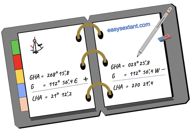
In this context, the formulas involve the calculation of the Greenwich Hour Angle (GHA) and Local Hour Angle (LHA) of celestial bodies, such as the Sun or stars.

Examples 360° formulas:
When performing calculations involving bearings or hour angles, results can sometimes exceed 360° or become negative. Because a full circle equals 360°, we must always bring the value back within the range 0°−360° by adding or subtracting 360° as needed.
148°22′.5 + 256°23′.3 = 404°45′.8
In this case you have to subtract 360°
Result 44°45′.8
180°56′.6 – 256°23′.9 = – 75°27′.3
In this case it is necessary to add 360°
Result 284°32′.7
For GHA and LHA the result must always be between 0° and 360°
Key Points in Maritime Navigation Formulas:
Compass Navigation:

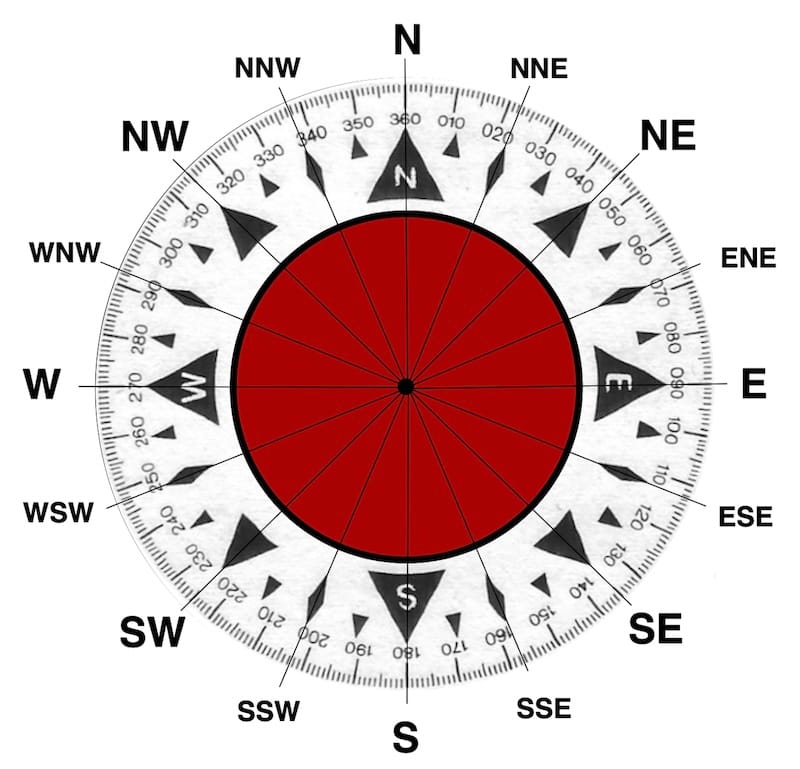
Also, in compass navigation, the circle is divided into 360°, with true north elegantly represented at 0° or 360°.
Notably, the compass rose, a circular diagram on the compass card, vividly displays the entire 360°.
Furthermore, intermediate points intricately divide each cardinal point into eight sub-divisions, resulting in a comprehensive 32-point compass rose.
Celestial Navigation:
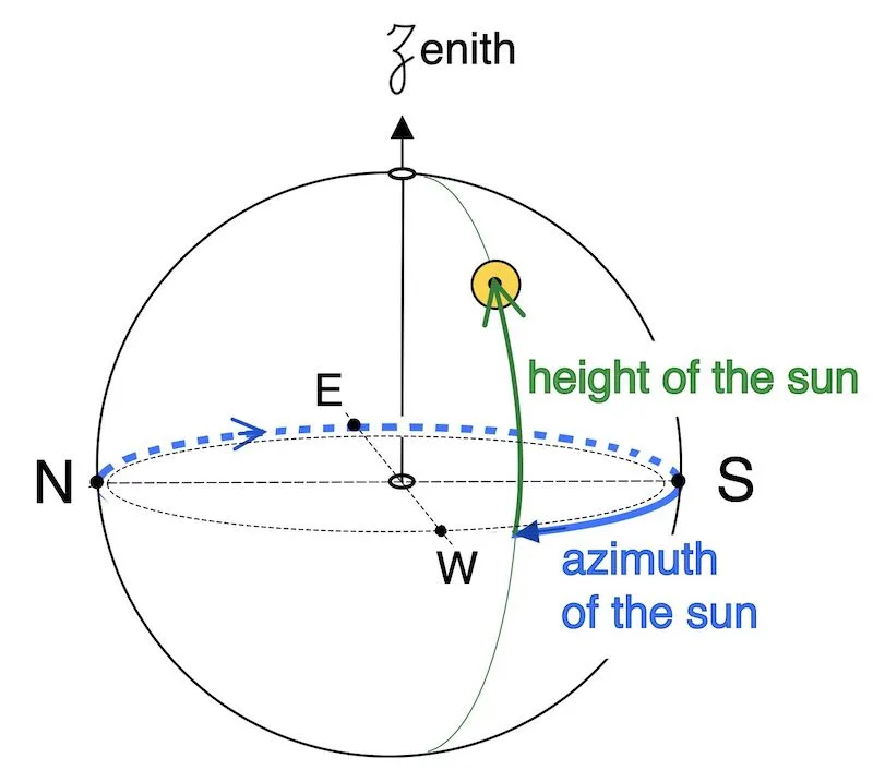
In celestial navigation, the celestial sphere surrounds the Earth, with the horizon meticulously segmented into 360° to seamlessly align with azimuth degrees.
Moreover, azimuth, a pivotal measurement, gauges the horizontal angle from a reference direction, typically measured clockwise from the north and spanning from 0° to 360°.
In fact, integral to celestial navigation, Sextant Reading involves using a sextant to precisely measure the angle between a celestial body and the horizon.
As a result, this crucially measured angle, often expressed in degrees, seamlessly integrates into the overarching 360° system.
Course and Bearing:

Indeed, a vessel’s course, delineating its steered direction, is conventionally expressed in degrees true, measured clockwise from north.
Relative bearings define the horizontal direction to an object or point and are usually measured in degrees from the ship’s head. Like courses, they follow the standard 360° system.
