

Sun’s Celestial Navigation Aid and Tools is a recommended self-instruction website, ideal for beginners as well as seasoned navigators refreshing their skills, with an exclusive focus on sextant Sun sight observations—the most practical and commonly used method in celestial navigation—and is entirely free.

🧭 New Feature: Step-by-Step Illustrated Guide to Adjusting Your Own Magnetic Compass
For Ocean-Going Sailing Vessels (30–60 ft)

🧭 New Feature:
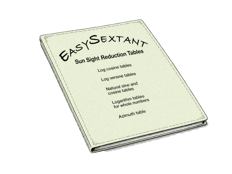
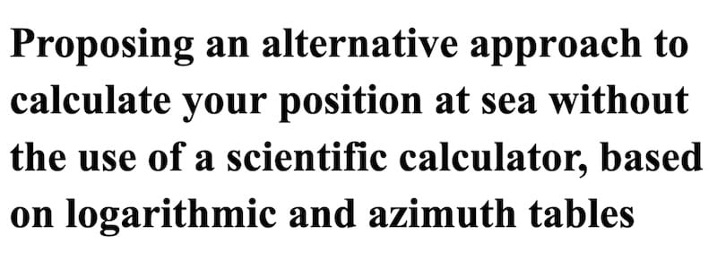
Permanent Sun Sight Reduction Tables
Designed for simplicity and reliability at sea, these tables allow complete sight reduction without the need for a calculator or additional tools.
- Streamlined calculation grid based on logarithmic tables
- Integrated azimuth and altitude correction tables
- Chronologically organized for fast use
- A complete, self-contained system for practical celestial navigation using the Sun, including nautical almanacs covering the years 2026–2040.
A simple 50-pocket document folder is all you need to carry the complete set on board—and keep it for life.
Recommended by Easysextant as the most essential feature of this website.

Introduction to celestial navigation:

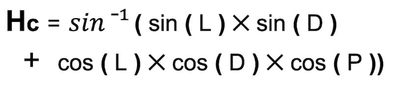
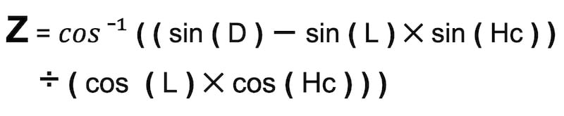
Sun-Based Celestial Navigation Tools: A Synopsis of Calculating the Line of Position Using a Scientific Calculator
The skill of calculating a line of position (LOP) using the sextant and the sun is essential for celestial navigation, and our interactive worksheet simplifies the process.
The course is free and includes examples for every step to obtain your line of position.
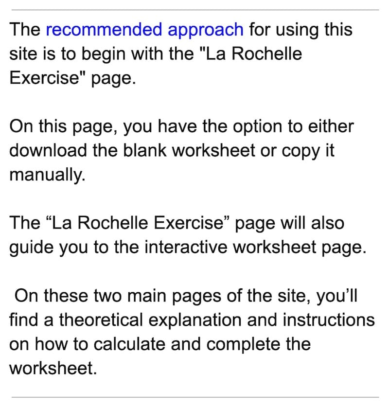
I want to emphasize that the ‘La Rochelle Exercise’ page — which leads to the interactive worksheet — is one of the two cornerstone pages of this website.
Remember that starting and completing the La Rochelle exercise will take time and effort for beginners

What is a line of position (LOP) ?
A Line of Position (LOP) is a straight line marked on a nautical chart on which one is located somewhere, determined through the use of a sextant and pertinent calculations.
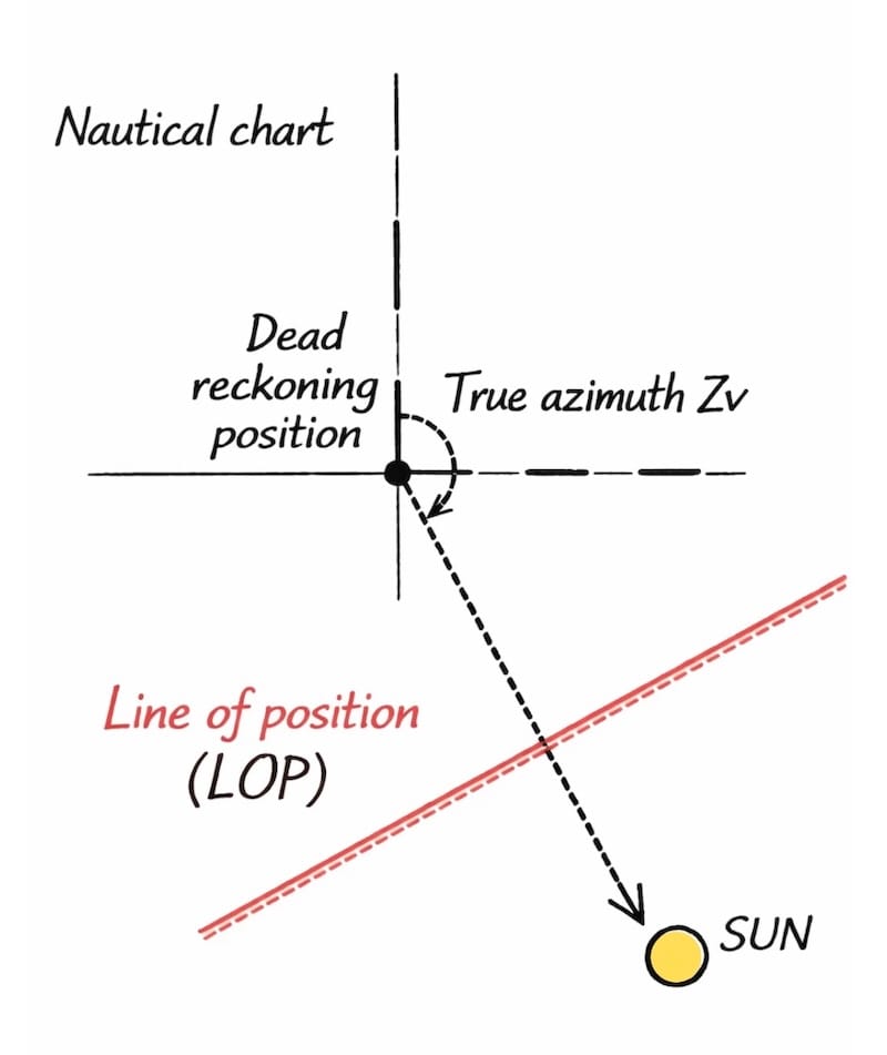
The main purpose of this website is to provide instructions and guidance on how to plot, calculate, and understand a line of position using the sun with traditional methods.
In summary, while a Line of Position indicates that the vessel’s location is somewhere along that line, it does not provide a precise fix on its location.
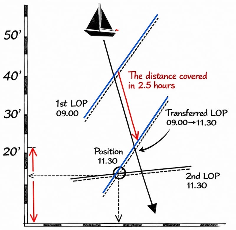
Accurate determination of a vessel’s position requires the intersections of at least two LOPs !
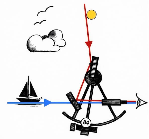
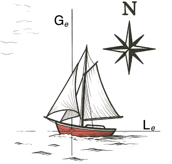
Take an initial observation with the sextant to measure the height of the sun above the horizon and calculate the first LOP.
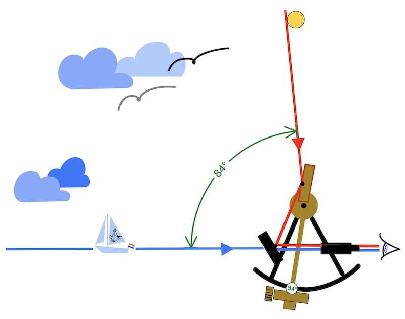
Then take a second observation some time later when the sun moves from east to west and changes its azimuth angle. Calculate the second LOP and intersect these two lines to determine your position.

Of course, there are several other factors to take into account, such as the movement of the ship between the two lines of position . However, the most important purpose of this website is to calculate this simple LOP.

In conclusion, LOPs are a fundamental part of celestial navigation, which has been used by mariners for centuries to determine their positions at sea when other means of navigation, like GPS, are unavailable or unreliable.

The main goal

Indeed, the main goal of this website is to provide information on how to calculate this LOP (Line of Position).
To summarize, this process involves transitioning from the observations made with the sextant to drawing a straight line on a map.
Finally, eight identical exercises are conducted in various oceans, in the Northern and Southern Hemispheres, and at different times of the year, with the Sun as the only celestial object.
These exercises simulate the application of the following tools:
- A sextant,

- The nautical almanac

Or
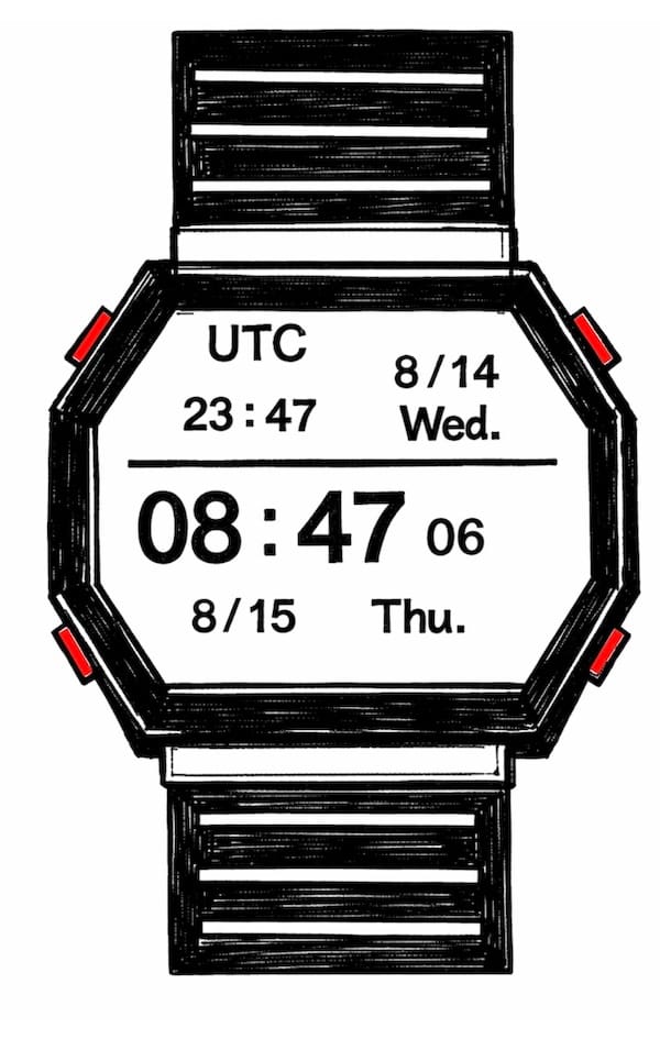
- A watch
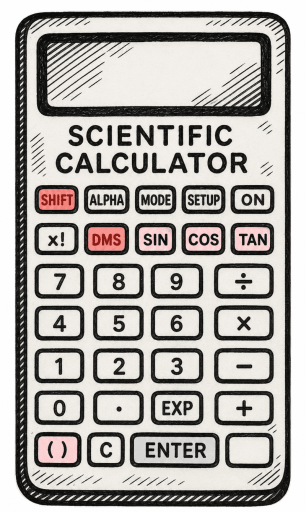
- a scientific calculator or tables
Or
- Dead reckoning position

Navigational knowledge required
This course requires a minimum level of navigational knowledge.
Placing a geographical point on a map, drawing a course line, and measuring a distance in nautical miles.
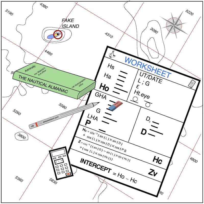
The interactive worksheet
The course is based on the use of a scientific calculator or the easysextant Sun Sight Reduction Tables, accompanied by a worksheet (grid) for manual completion.

Free interactive worksheet accompanies manual completion, providing detailed theory and calculations guidance.
This interactive worksheet is the most important tool of this website.

Once you have completed the “La Rochelle” exercise, you may continue with seven additional, identical exercises designed to reinforce the method.
All correct answers are now provided free of charge in PDF format. In keeping with the spirit of the site, all content is open access and the store has been removed.
You can find these documents on the celestial course page.

Comments

Hence, in this course you will not find topics like stars, moon, planets, or detailed sextant description. My aim is to avoid overwhelming the student with too much information.
In this course, I do not take for granted that you already know how to use the formulas. Instead, I provide an explanation of how to use them.
The method we use in this course is the Marcq Saint-Hilaire method, which is employed in navy schools worldwide.
We carry out these exercises at various times throughout the year, in different oceans located in the Northern and Southern Hemispheres.
Except for students at naval schools who must work with the formulas, I recommend the easysextant SunSight Reduction Tables — a tool for life.

Also featuring on this site: Practical Noon Sight and Watch Planning
You will also discover how to calculate a local apparent noon sight. (an exceptional LOP that simplifies the calculation but can only be taken once a day, around midday.)
Moreover, you will learn how to plan your day for the interval between two Lines of Position (LOPs).
Additionally, the benefits of these exercises.

– Certainly, You will be able to obtain your position at sea!
– Obviously, it will be easier for you to clear your exams at the Merchant Navy school.
-Basically, you will find the same formulas for the Moon, stars, and planets, so this course is also interesting for the midshipmen in the naval academy.

In conclusion, the main goal should be to fully master the “La Rochelle” exercise, as doing so will make tackling the remaining exercises a more enjoyable experience.
Sun’s Celestial Navigation Aid and Tools:


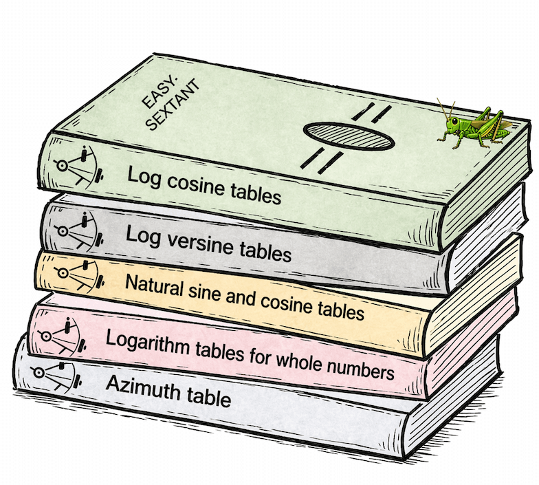
Here, I introduce an age-old celestial navigation technique involving logarithms.
A Simple Step-by-Step Method
Don’t worry — the method simply uses the values from the first part of the worksheet. To determine Hc using logarithmic tables, add the logarithmic values, then convert the result back into a natural number, all using the grid. It’s like playing a game with a few simple rules: follow the steps, combine the values, and you’ll find Hc.
Focus on Practice, Not Theory
Logarithms turn complex multiplications into simple additions, and mastery lies in using the tables and completing the grid, not in the underlying theory.

This section is provided as an additional feature of the website. It highlights that celestial navigation can be performed using only logarithmic tables and the nautical almanac, without relying on any electronic device on board.
In order to keep the calculations accessible for the intended audience, four-decimal logarithmic tables are used instead of the traditional five-decimal tables.
This reduces the complexity of the computations while preserving sufficient accuracy for practical navigation. The permanent tables have also been designed to keep the number of downloadable pages to a minimum.
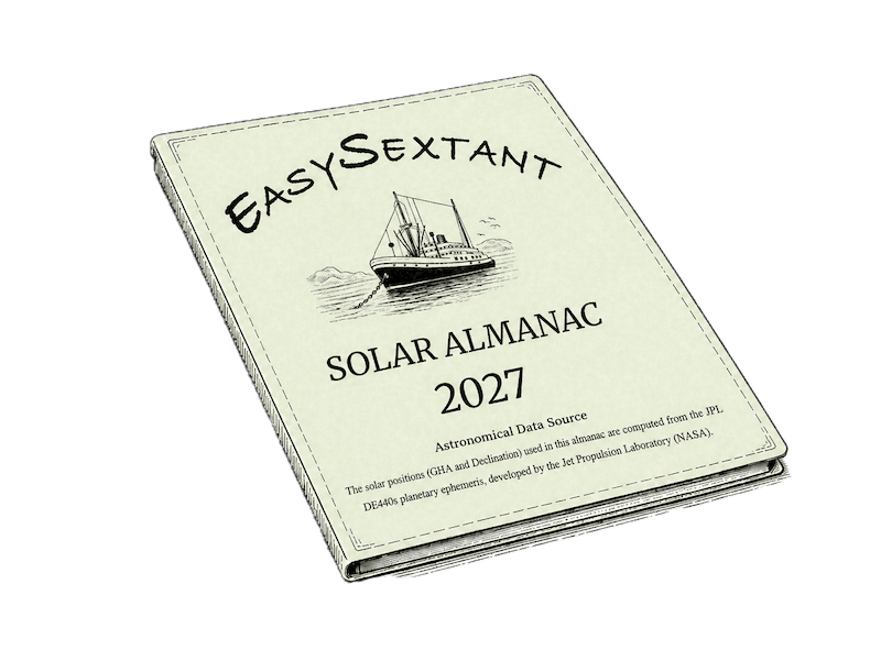
A simplified Sun Nautical Almanac is also provided for the years 2026 to 2040, with 20 pages per year.
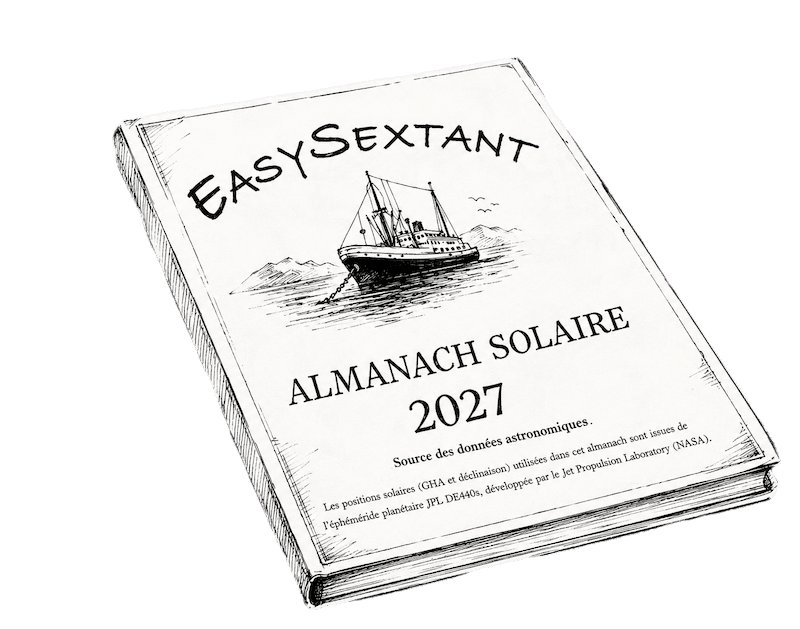
You can select and download the year you need, allowing the navigator to work efficiently with the Sun for celestial observations.
.
