
The primary objective of this website is to provide guidance and interactivity for calculating the Line of Position (LOP)

It’s worth recalling that Sumner’s breakthrough—the line of position—transformed navigation and led to advanced methods like Saint-Hilaire’s, used on this website.
Users can then trace this line on a universal plotting sheet.

Universal plotting sheets are blank charts that can be used for a variety of navigation tasks. Indeed, they are a versatile tool that can be used for plotting positions, courses, and celestial navigation data.
Certainly, you can develop a marine plotting sheet using pre-existing templates accessible online or obtainable from marine shops.
Additionally, valuable information on this subject can be found on Mr. David Burch’s outstanding navigation blogspot.(with links to free downloadable PDF universal plotting sheets)
Also, check out my page on how to make your own plotting sheet
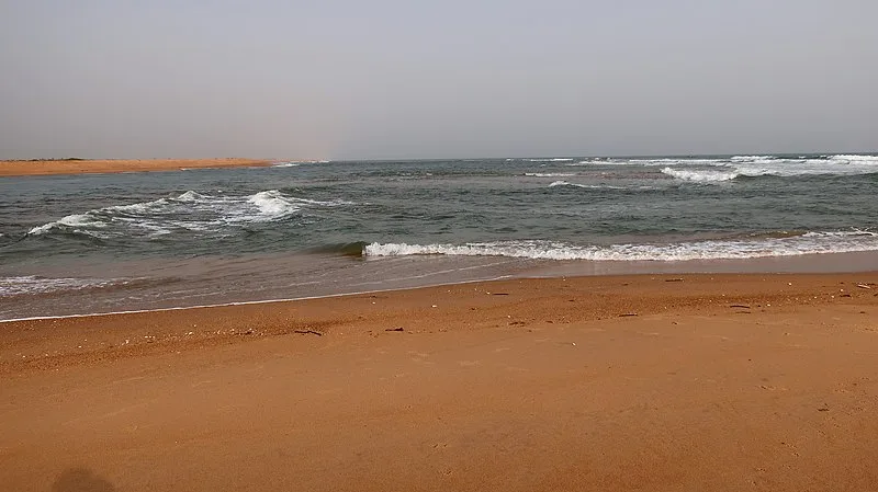
The Mono river meets the Atlantic ocean. Author Image: kultuurnavigaattori
Universal plotting sheets
Features of Universal Plotting Sheets:
Overall, the sheets enable you to create a chart for any geographical location and scale.
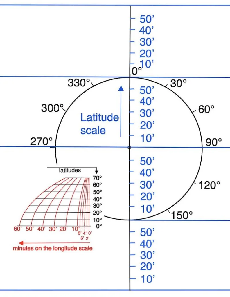
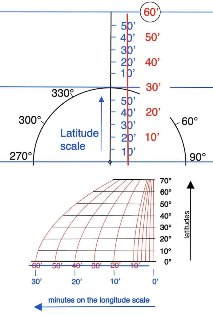
Consequently, a graduated circle is printed at the center of the sheet, allowing you to construct with the help of the nomogram meridians of longitude for any latitude.


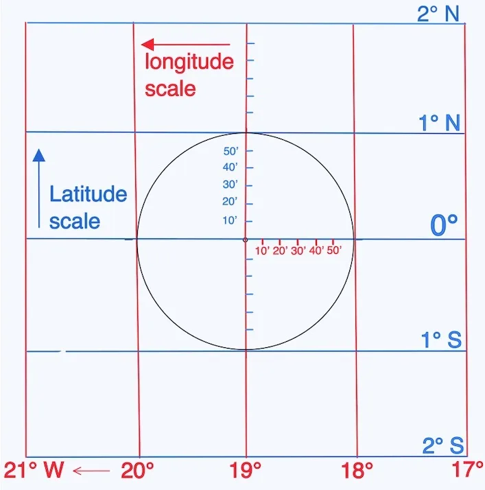
Nomogram Examples for Latitude 0° and 65°
Hereafter, we will examine the visual Nomogram Examples for Latitude 0° and 65° of an ocean plotting sheet through two examples—one situated near the equator and another positioned approximately at 65°N.
The objective is to create a chart featuring a 4° interval on both the latitude and longitude scales, aligning with your navigation project.
Example 1: Plotting at the Equator (0° Latitude)
Two immovable elements:
- A plotting sheet template and a fixed latitude scale with a span of 4 degrees.
- A nomogram
Objective: Use the nomogram and your selected latitude to determine the longitudinal scale.


Hence, as is commonly understood, the minutes on the longitude scale correspond in dimension to the miles on the latitude scale at the equator, as illustrated on a typical Mercator chart.
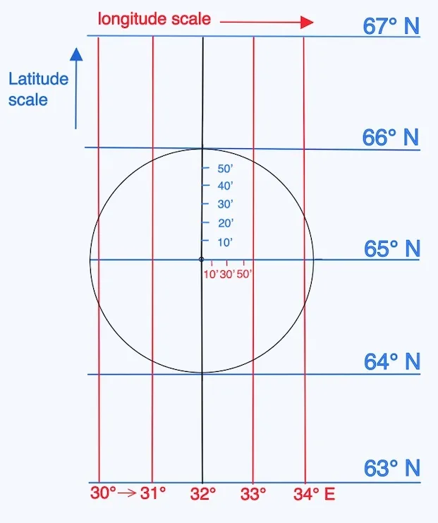
Example 2: Plotting at High Latitude (65°N)
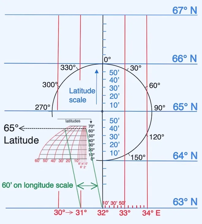
As a result, we have a chart depicting high latitudes, and it is nearly unreadable. Therefore, I intentionally chose this example to highlight the challenge in deciphering the longitude scale in such conditions.
A plotting sheet model with the latitude scale fixed at 2-degree intervals.
Since the plotting sheet was designed for a 4 degree interval, we can modify it as follows below:
We adapt the latitude scale and find from the center of this sheet 1° north and 1° south. Subsequently, we adopt the longitude scale with our monogram.


Alternative Method: Using a Formula Instead of a Nomogram
Suggesting the creation of a straightforward plotting sheet on letter-sized paper featuring a formula instead of a nomogram.
However, using a larger-sized paper would offer greater comfort, especially when placing it on the back of a marine chart, for instance
The formula;
The length of the latitude scale ✕ cosine (D.R. latitude) = length of longitude scale

You have the option to measure length using the metric system, employing units such as centimeters (cm) or millimeters (mm). Also, you can opt for the U.S. customary system, utilizing inches, half inches, or quarter inches according to your preference.
Two examples: build the sheet using a cosine-based formula.
Latitude 32° (U.S. customary system)

Latitude 32° (metric system)
