


The nautical mile and astronomical navigation: In navigation and aviation, especially at sea, the nautical mile is used as a unit of measurement. It is equivalent to one minute of angle along a meridian on Earth.

Use in Navigation and Charts
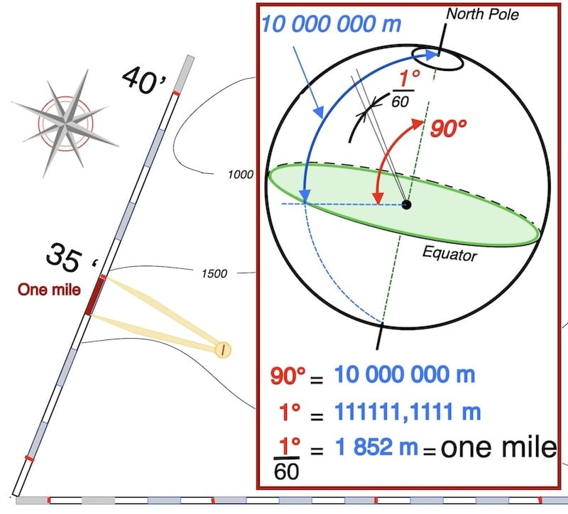
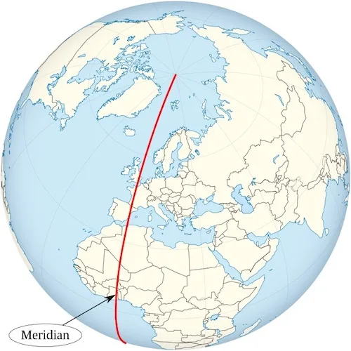
A nautical mile is defined as one minute of arc measured along any meridian on Earth.

In terms of distance, a nautical mile is equal to 1.852 kilometers.
People commonly use it to measure distances at sea or in the air.
The use of NM, the internationally agreed-upon measure of one nautical mile, which is exactly 1.852 meters, remains in place today

The nautical mile and astronomical navigation
Understanding the Earth as a sphere helps explain the nautical mile, which is based on Earth’s circumference of approximately 40,000 kilometers. One nautical mile corresponds to one minute of arc along a meridian.
After dividing the half-circle into equal portions of 360°, one can further divide these degrees into 60 minutes.

Classic explanation
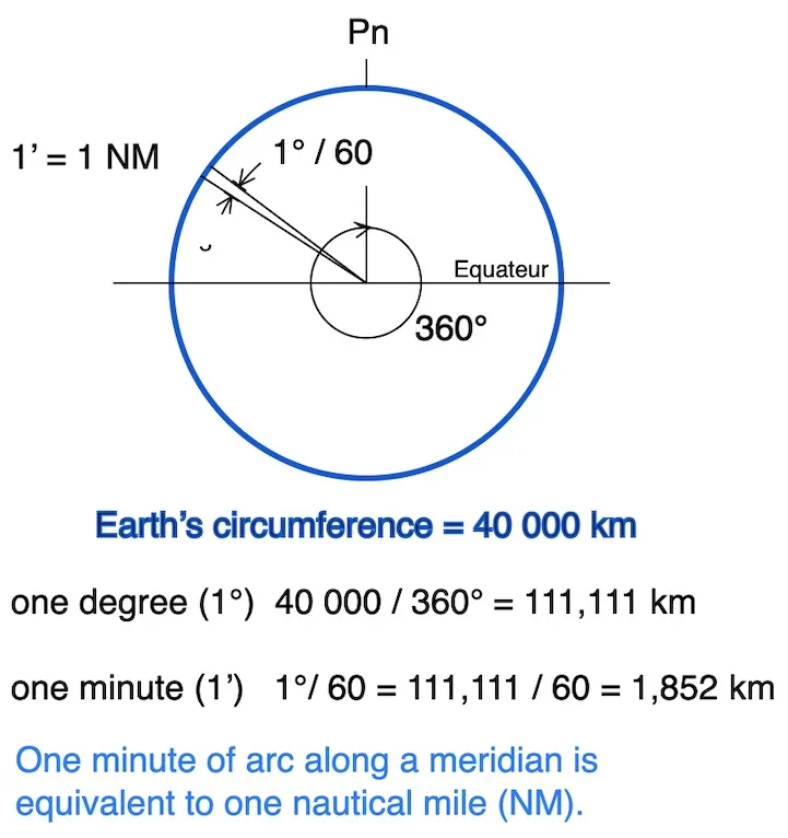
Within navigation, one of these minutes (also referred to as minutes of arc) along a great circle on Earth represents a single NM.

overall, nautical charts employ one of three map projections: the gnomic, polyconic, and Mercator.
As a matter of fact, among these three, the Mercator projection takes precedence as lines of latitude and longitude intersect at right angles, creating a rectangular grid.

In fact, this grid enables users to plot straight lines.
This projection is used for nautical charts because it preserves the shape of continents and maintains angles, which is convenient for navigation with a compass.
Mercator maps are not usable at high latitudes due to extreme distortion of distances and areas, making the geographic representation inaccurate and impractical for navigation.

Also, on this website, we explore creating a simplified plotting sheet inspired by the Mercator concept
Indeed, incorporating the NM, which represents one minute of latitude, greatly simplifies navigation in open water.
Consequently, it assumes a vital role in exploration, shipping, and geography, contributing significantly to these fields.

Difference between a nautical mile and a knot. NOAA
