
On this page, Understanding the Greenwich Hour Angle in Celestial Navigation, we emphasize the significance of understanding Greenwich Hour Angle, a crucial factor in comprehending and calculating the Line of Position (LOP), which constitutes the main objective of this site.
Introduction to the Greenwich Hour Angle (GHA)
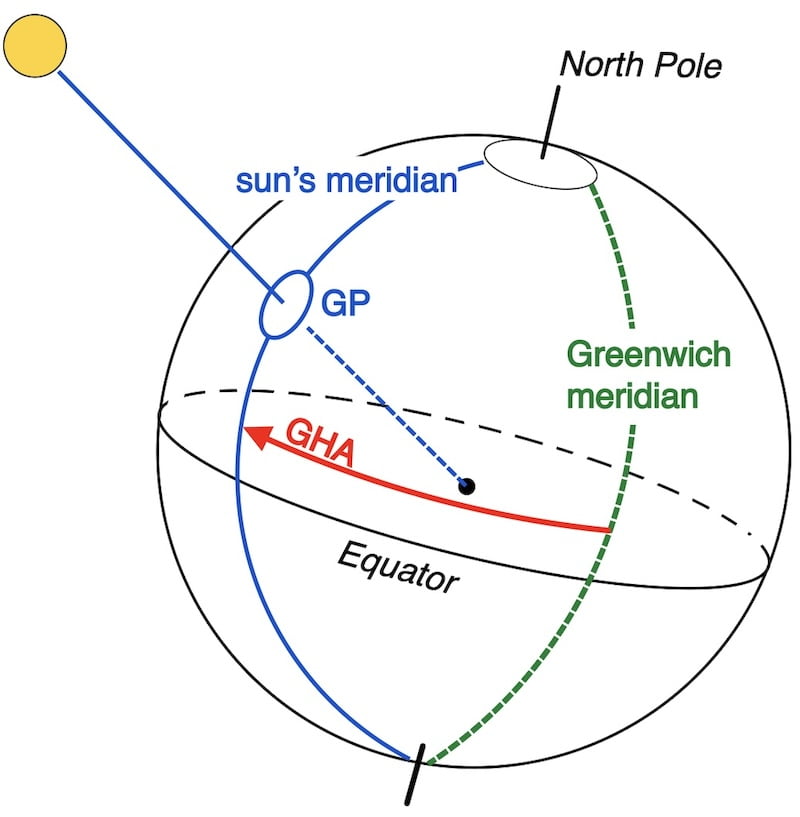
Greenwich Hour Angle : the solar coordinate system involves two key components: Solar Declination (D) and Solar Greenwich Hour Angle (GHA).

Our mathematical formulas, which resolve the spherical triangle, utilize these data, obtained from the Nautical Almanac’s daily pages.

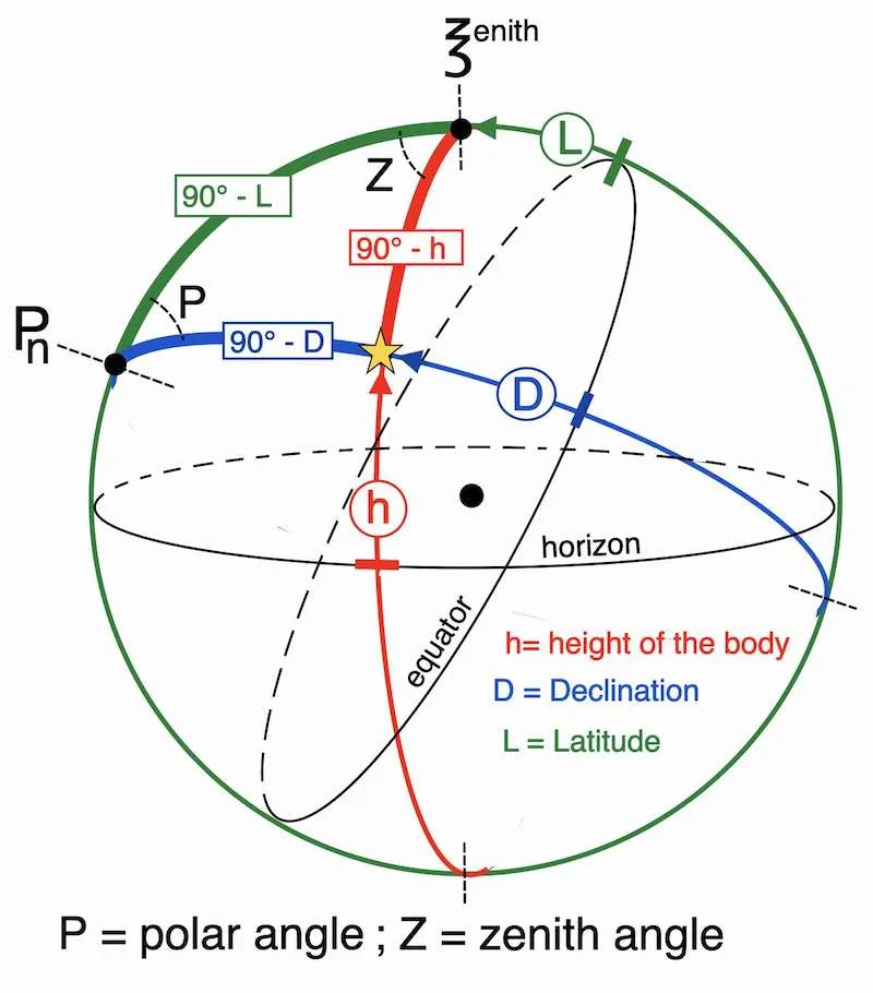
Geographical Position (GP), also called the substellar point.

The thread stretching between a body’s center and the Earth’s center strikes the Earth’s crust at point GP
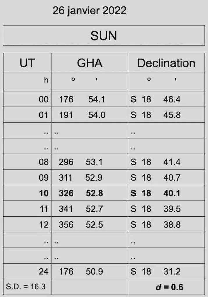
The nautical almanac for the sun:


GHA and Declination are simply the coordinates on earth for point GP.
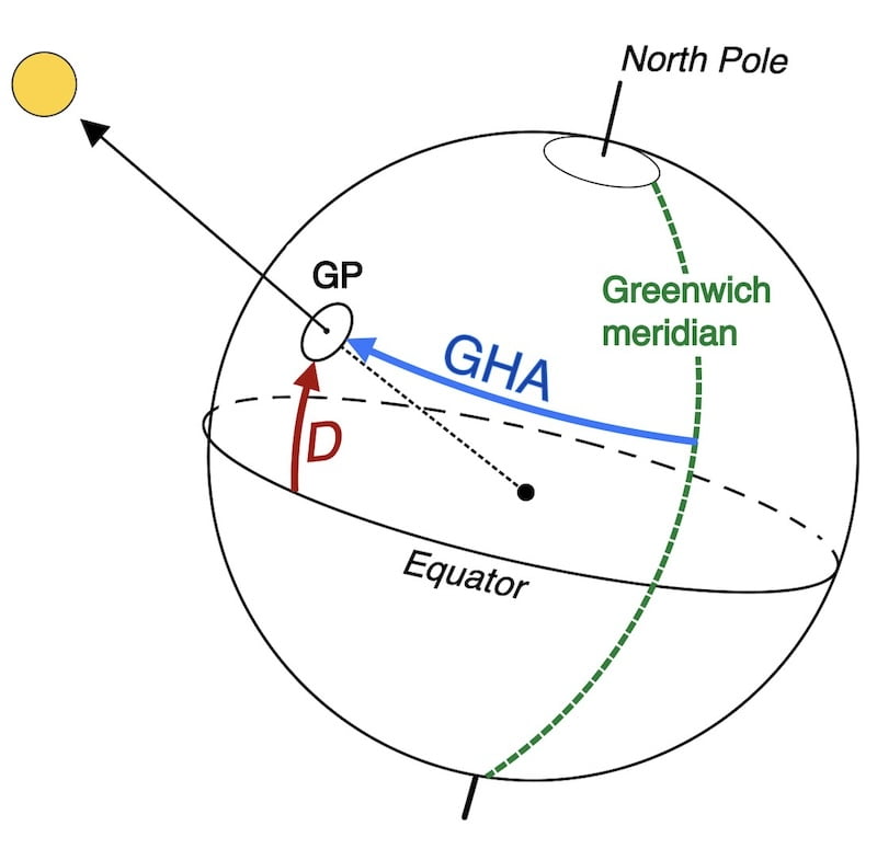
Indeed, it can be concluded that D is equivalent to the latitude and GHA is equivalent to the longitude of the point GP at that moment.
In fact, the declination of the sun (latitude) can never exceed 23° 26′ N or 23° 26′ S.
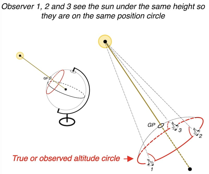
The point GP is likely too distant to be directly plotted on a nautical chart.
However, our mathematical formulas (resolution of the spherical triangle) use the two data points: GHA (Greenwich Hour Angle) and D (Declination) of this point GP.

Longitude vs Hour Angle: A Subtle Difference
There is a subtle difference in how longitude G and GHA are expressed, though they yield the same results.
Indeed, the hour angle progresses from 0° to 360° in a westward direction.
Alternatively, when referring to the coordinates on the Earth’s surface, we utilize longitude East (ranging from 0° to 180°) and longitude West (ranging from 0° to 180°).
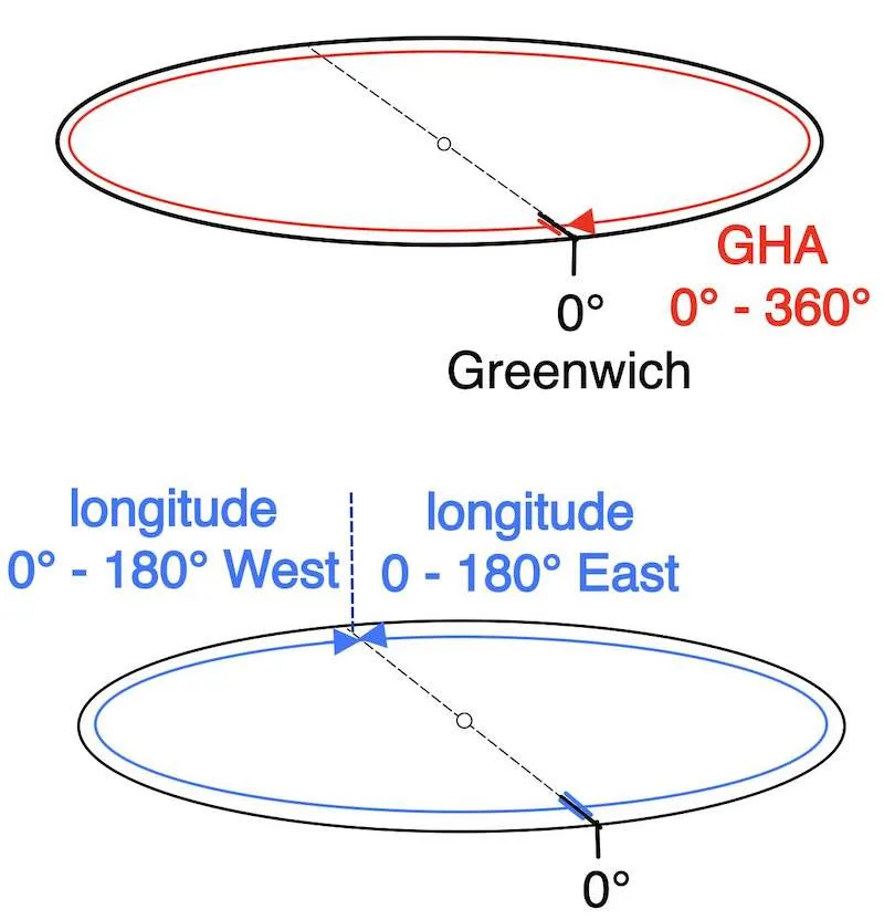

In fact, the manipulation that needs to be performed is handled by the formulas.

Why Accuracy Matters: Time and Intercept Error
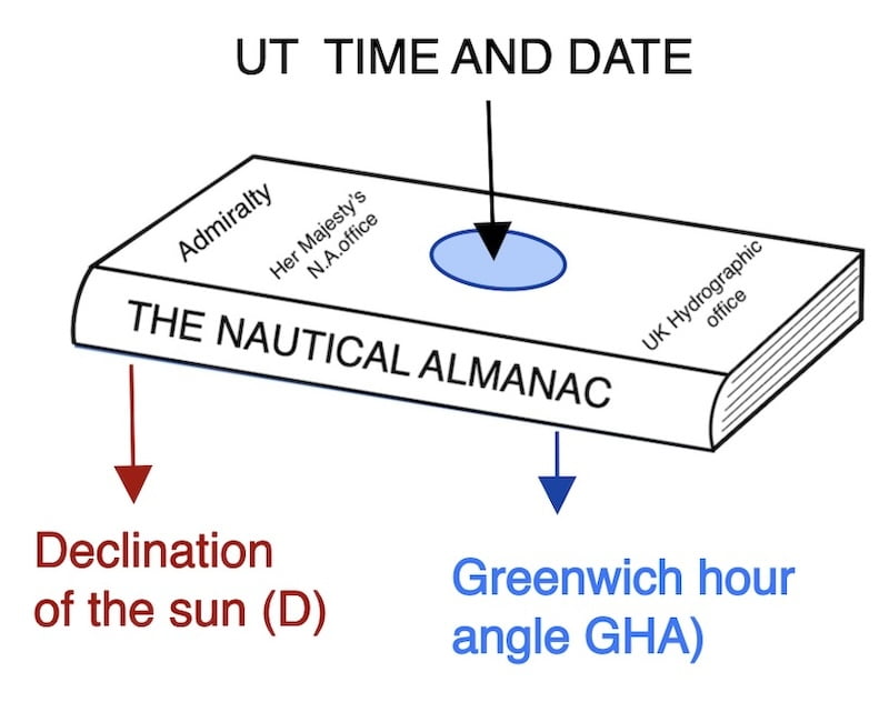
The Nautical Almanac provides the Sun’s Declination and GHA for each day and every whole UT hour.
Therefore, it is up to us to interpolate to have the Declination and GHA at the exact UT time of the observation
That is to say, to the nearest second !
Keep in mind that an error of four seconds creates an error of one mile on the intercept length.
How to calculate the GHA to the nearest second ?