
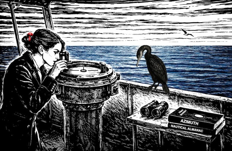
This webpage, “Azimuth and Celestial Navigation”, is designed to underscore the importance and understanding of the sun’s azimuth in celestial navigation at sea, specifically in calculating the Line of Position (LOP) .
Overall, our website is dedicated to providing precise guidance on the calculation of LOP, assisting mariners in finding their way through celestial navigation at sea.

description true azimuth (Zv) :
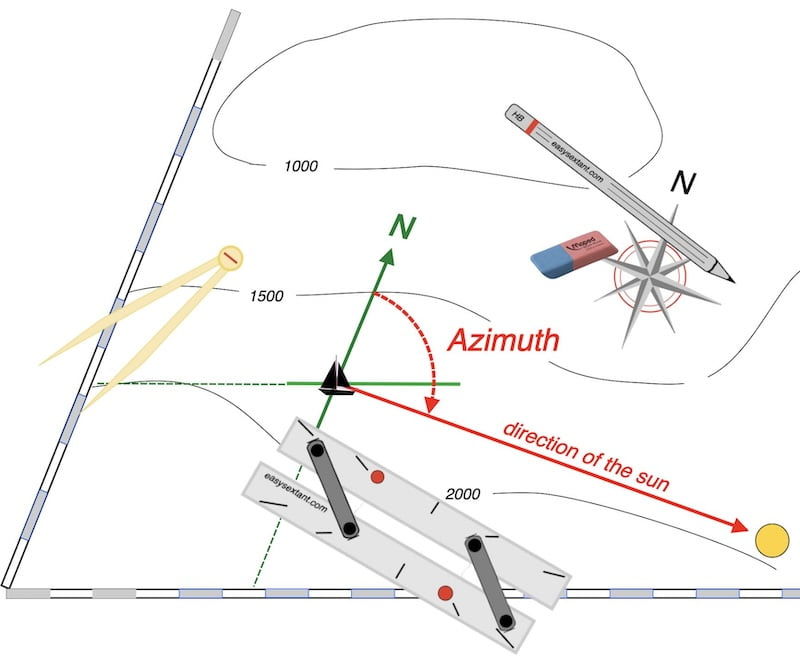
Indeed, azimuth is a mathematical concept used in navigation and surveying to describe the direction of a point relative to a reference direction, typically north.

Furthermore, it is usually measured in degrees, clockwise from north, and ranges from 0° to 360°.
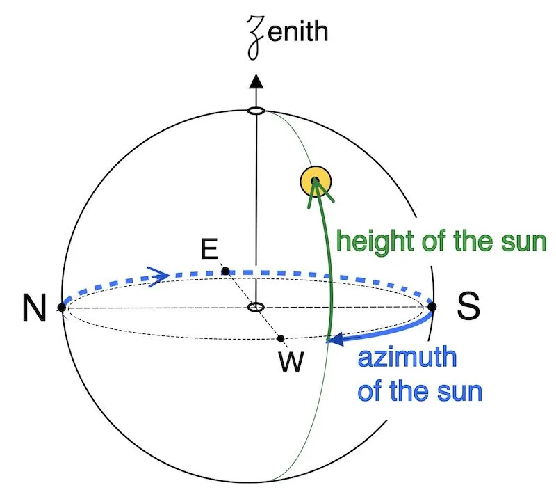
That is to say, true azimuth Zv: counted from the north cardinal point, from 0° to 360° (clockwise)


True azimuth (Zv) calculations
From Z to Zv
Our formulas for the Z calculation cannot give values between 0° and 360° but only between 0° and 180°
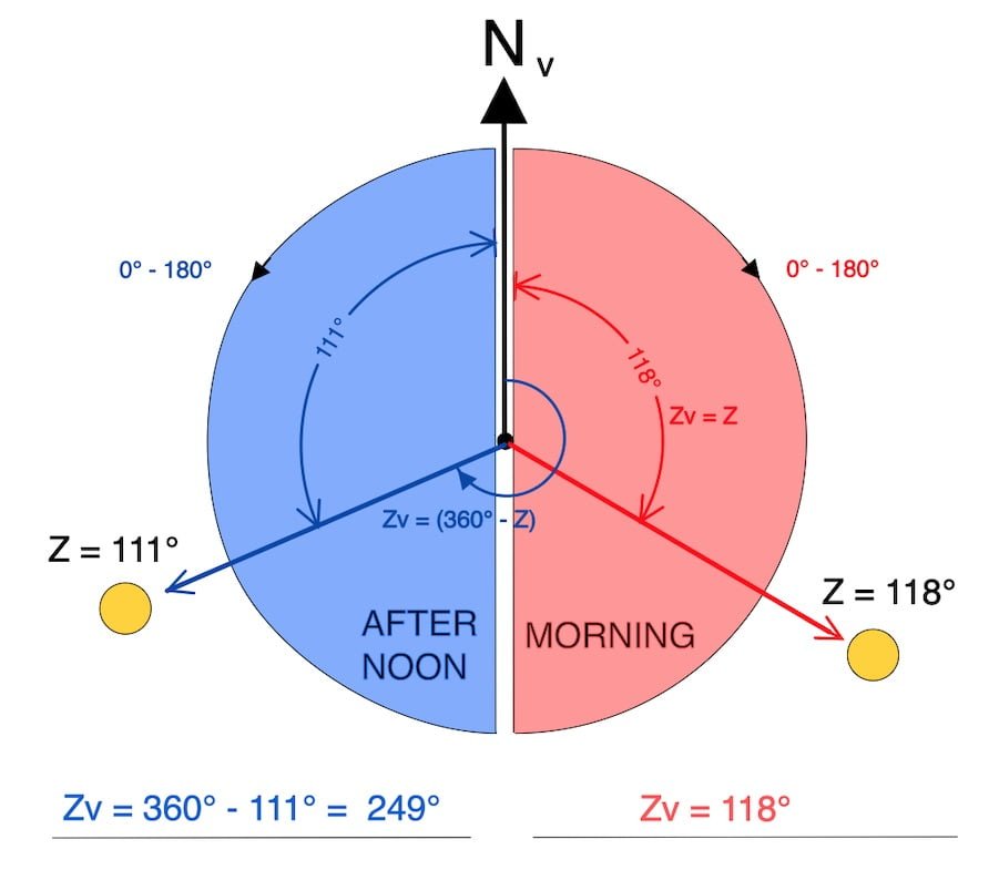
From 0° to 180° East red side
While the Sun is in the East, the sun’s height increases.
From 0° to 180° West blue side
While the Sun is in the West, the sun’s height decreases.
It is up to the navigator to convert these values to the modern 0°⎼ 360° azimuth notation (Zv).
ロ Sun in the East ⟹ Zv = Z
ロ Sun in the West ⟹ Zv = 360° – Z
Sun in the east or west
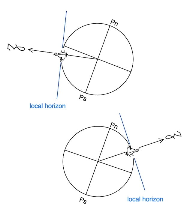
Azimuth and celestial navigation: How can we determine if the sun is in the east or west?
Also, the calculated local hour angle (LHA) will indicate if the sun is in the east or in the west.
ロ LHA < 180°
sun in the West
ロ LHA > 180°
sun in the East
However, the individual who uses a sextant to observe the sun’s position acknowledges that the sun is in the eastern direction when it is still ascending in the morning and in the western direction when it descends during the afternoon.
In conclusion, our formulas for the Z calculation can only provide values between 0° and 180°, not between 0° and 360°.
Therefore, we transform it into the modern notation Zv (0° to 360°).
Example: The Z formula gave a result of 40°. Because the observation occurred in the afternoon, we know the sun was in the west.

However, since we know that the sun is in the West, we can calculate Zv by subtracting Z from 360°, resulting in a value of 320°.
ロ Sun in the East ⟹ Zv = Z
ロ Sun in the West ⟹ Zv = 360° – Z

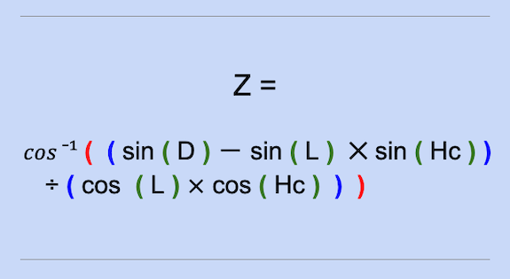
The formulas used to calculate the final azimuth.

L =
D =
P =
L =
D =
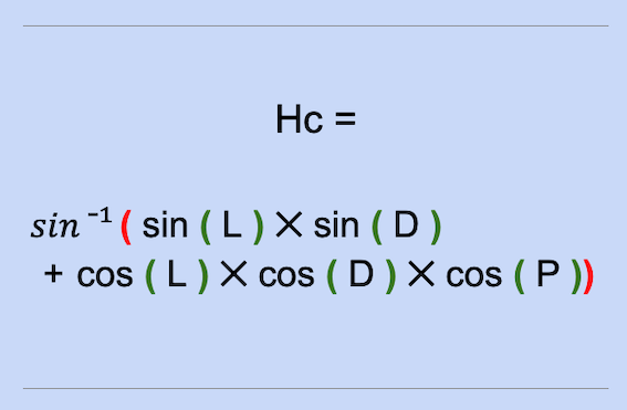
Hc =
The formulas used to calculate the final azimuth only yield values between 0° and 180°, so they must be converted to the modern 0°–360° notation, as shown below.
ロ SUN in the east ⟹ Zv = Z
ロ SUN in the west ⟹ Zv = 360° – Z
Zv =
Zv calculation: two exercises complete with solution
