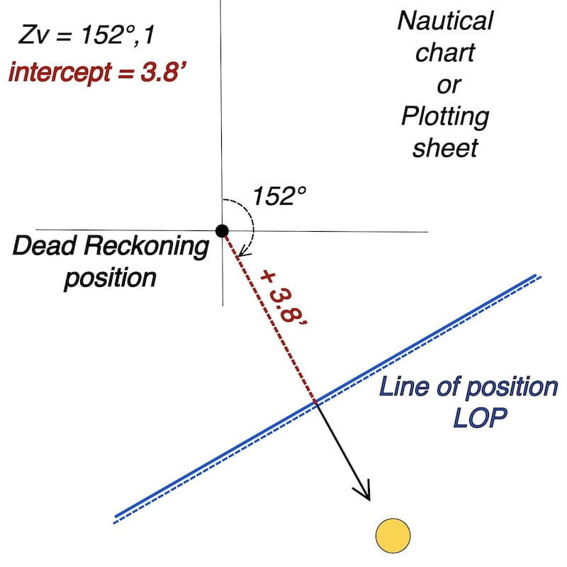
Sun’s LOP Running fix and uncertainty zone: a navigational position determined by the intersection of two or more lines of position taken at different times and then advanced to a common time.
On this page dedicated to transferring a Line of Position from the sun (LOP) and the uncertainty area, as part of a self-instruction website that simulates sun observation with a sextant (refer to the main exercise, La Rochelle) ,the primary goal is to guide you through all the steps using an interactive worksheet.
Ultimately, this will enable you to plot the Line of Position with its precision on a nautical chart or plotting sheet and find your way at sea.

👉 Sun’s LOP Running Fix – 3 examples

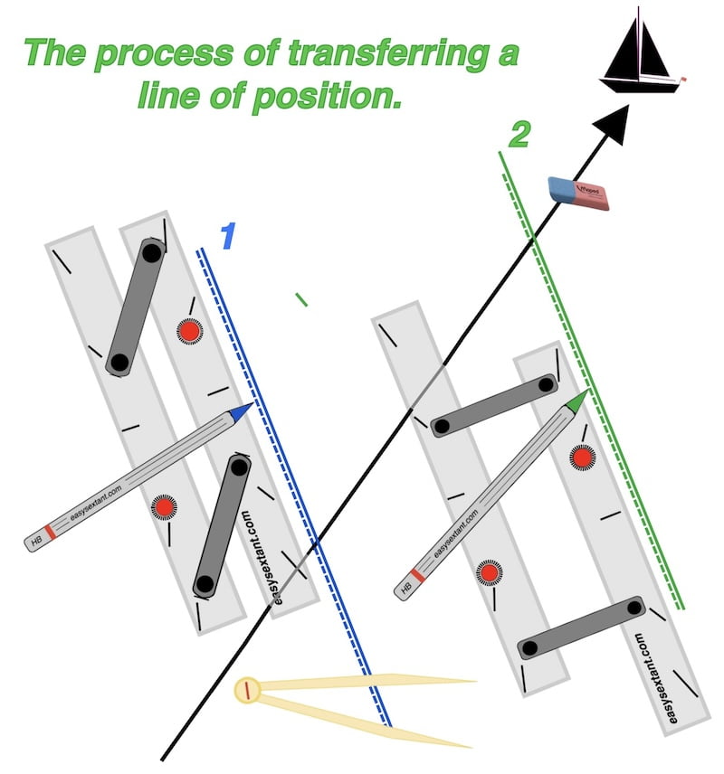
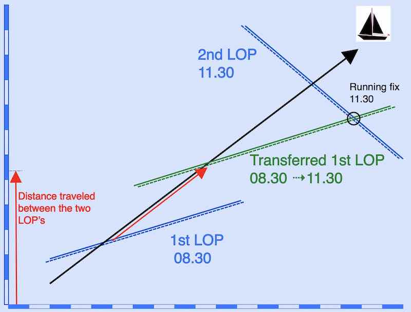
1st example:
Imagine you have taken two sun sights, one at 09:00 and another at 11:30, each based on a different dead-reckoning position.
Plot both of these Lines of Position (LOPs) on your chart or plotting sheet (as shown below).


Next, determine your vessel’s estimated true course (black) and the distance run (red) between the two DR positions.
Extend your estimated course line until it cuts across both LOPs — the important point is simply that it meets them; in other words, only the contact matters, not where it occurs.
Finally, transfer the first LOP forward by the estimated distance (red) and in the estimated direction of travel (black). Draw this transferred line parallel to the original LOP.
2nd example:


3rd example:
Here an example with a LOP in the morning and the local apparent noon LOP


The uncertainty of the fix
A renowned educator in France, authoring a book on celestial navigation, suggests that considering possible minor errors in typical conditions, it is advisable to assume a margin of uncertainty of two miles on either side linked to the LOP.
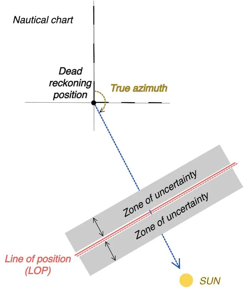
In addition, the transport increases the width of the uncertainty band of the transferred LOP.
The precision of the fix depends not only on the difference in azimuth, but also on the navigator’s confidence in the estimated course and the accuracy of the distance traveled between the two LOPs.
The objective is to achieve a difference in azimuth of the two LOPs close to 90° while minimizing the transfer time, although this may not always be feasible.
Note: A position is determined by two LOPs crossing at an angle — ideally near 90°. Even 60° gives a good fix, 30° is acceptable, but smaller angles enlarge the uncertainty area.

Even when making a landfall, an uncertainty area of 6 or 8 miles is not a problem with respect to the following conditions:
LOP Running fix and uncertainty zone: making Landfall

Gather Essential Charts and Data: Before setting sail, ensure you have accurate charts of the intended landfall area, including coastal outlines, navigational aids, and depth contours.
Obtain precise astronomical data, such as the sun’s declination and ephemeris tables for the relevant time period.
Transition to Visual Navigation: Upon approaching your intended landfall area, switch to visual navigation using landmarks, lights, or depth soundings.
Confirm your position with multiple visual observations and adjust the course accordingly.
Ensure Safe Arrival: Once you are confident in your position, take all necessary precautions to ensure a safe arrival at the intended landfall point.
This may involve reducing speed, taking soundings, or monitoring local weather conditions.
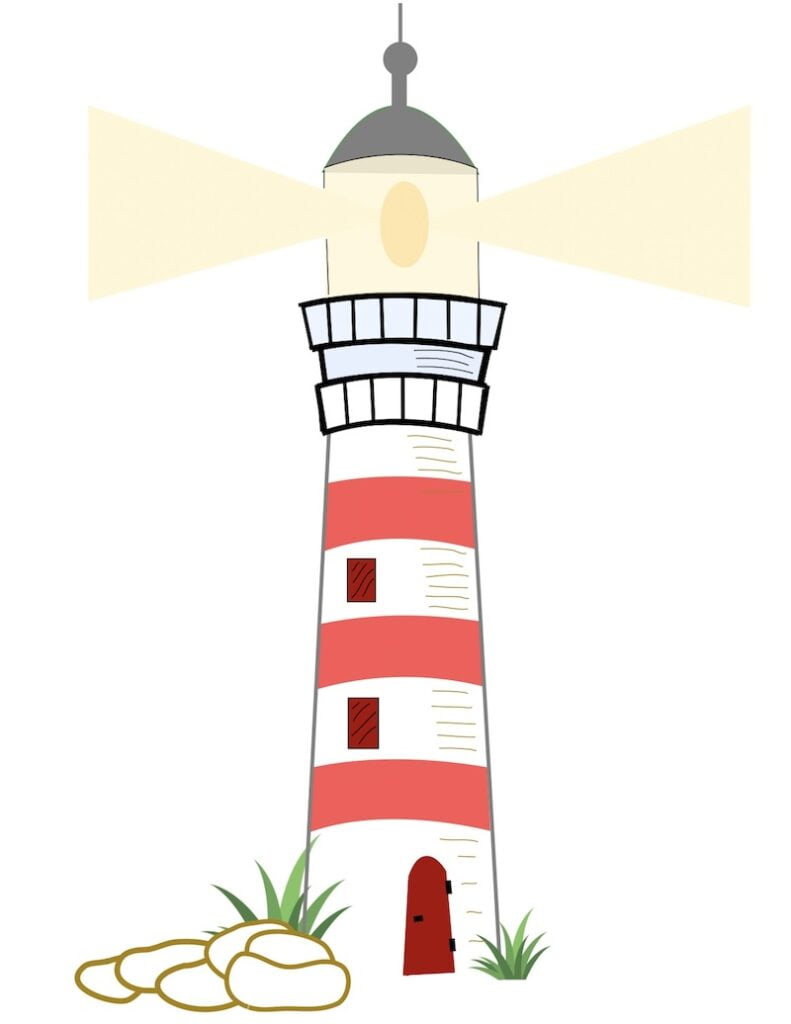
Lighthouses

Lighthouses
As you approach land after a long ocean passage, lighthouses become your most reliable companions. Each one is unique: its light pattern, color, and range are carefully designed so mariners can recognize it from miles offshore.
Before making landfall, study the lighthouses along your intended coast on charts or in the Light List. Note their identifying features and ranges.
When you finally spot a lighthouse, take a compass bearing and compare it with its charted position. A single bearing can check your DR track; two bearings, taken a few minutes apart or from different lighthouses, can confirm or refine the position you obtained from your celestial running fix.
Together, celestial sights and lighthouses form a bridge between open-ocean navigation and safe coastal landfall — one guiding you across the sea, the other bringing you safely to shore.
Navigational Principle:
After a long voyage, the temptation is often to reach the destination quickly. the inclination is often to reach the destination swiftly.
However, it’s essential to prioritize making prudent decisions, even if it means diverging from the preferences of your crew or passengers.
Opting to spend the night at sea might be necessary for a clearer visual and to ensure a safe arrival at the intended port.