EXAMPLE OF HOW TO CALCULATE THE ALTITUDE OF THE SUN (Hc) WITH THE TABLES
On this page Calculate Sun’s Altitude at Sea with Logarithm Tables, we will find a fully worked-out example of how to calculate the altitude of the sun (Hc) using logarithm tables at sea.
Start with the Logarithme MAIN page — it forms the foundation of the “Logarithmic” menu and contains all related links. It will guide you back here when needed.
In fact, observers who see the sun at the same altitude lie on the same circle of equal altitude (red circle).
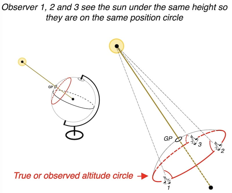
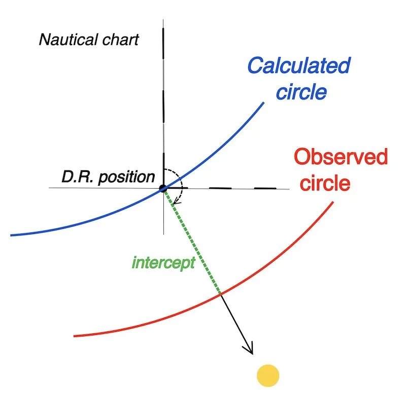
We can also calculate the sun’s altitude from our Dead Reckoning position (DR), resulting in another circle of equal altitude for the calculated values (blue circle).
Note: Under typical circumstances, the circles are so large that, locally, they can be regarded as straight lines.
For further information, please refer to the principles of the sun sight.
On this page, we focus on how to calculate the altitude of the sun with our D.R. position (Blue circle) using logarithm tables.

Example and solution
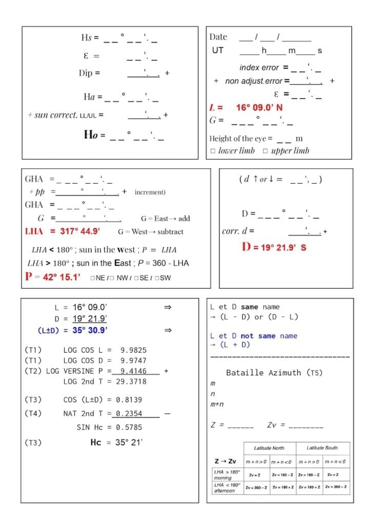
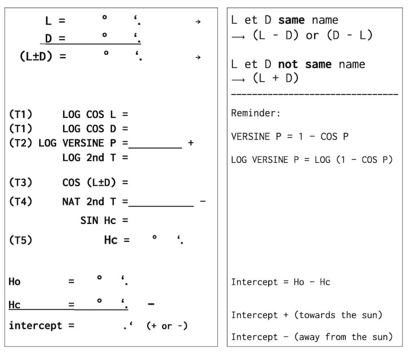
In fact, the inputs obtained in the first part (red) of the worksheet that are necessary to find the calculated altitude (Hc) are:
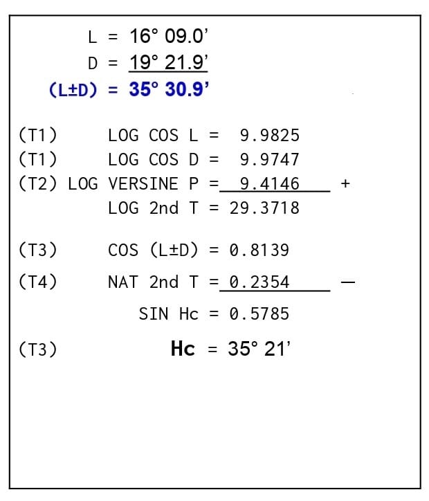
L = 16° 09′ N (D.R. latitude)
D = 19°21′.9 S (declination of the sun)
P = 42°15′.1 (NE) (polar angle)
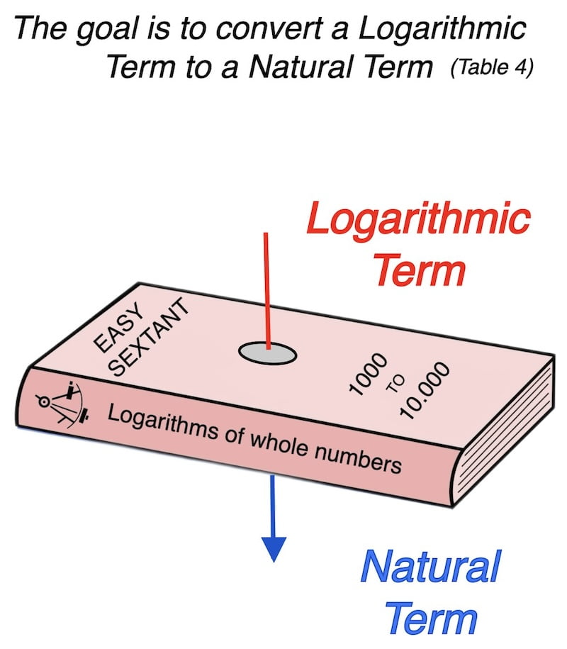
Sun’s altitude and logarithm tables at sea:
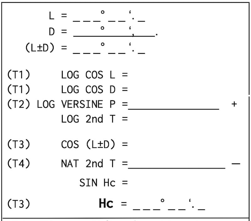
Table 1 (T1)
La table 1 permet d’obtenir les valeurs de log cos L et log cos D.
log cos L
Latitude = 16°09’N
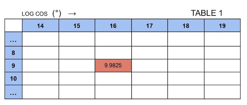
log cosine 16° 09′ on our scientific calculator gives us −0.017485.
It is nevertheless much more convenient to put these sorts of logarithms in the form of positive quantities.
U.S. or British common logarithm tables are then presented in the following form:
10 + (−0.017485) = 9.9825
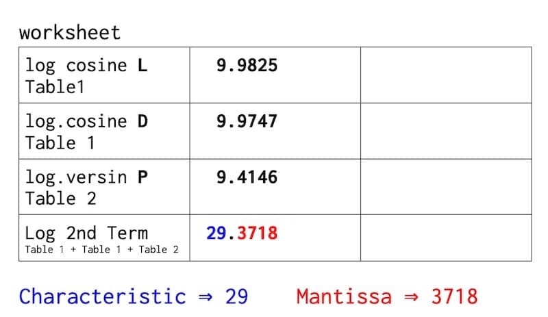
Log cos L = 9.9825
Log cos D
Declination = 19° 21′.9 S
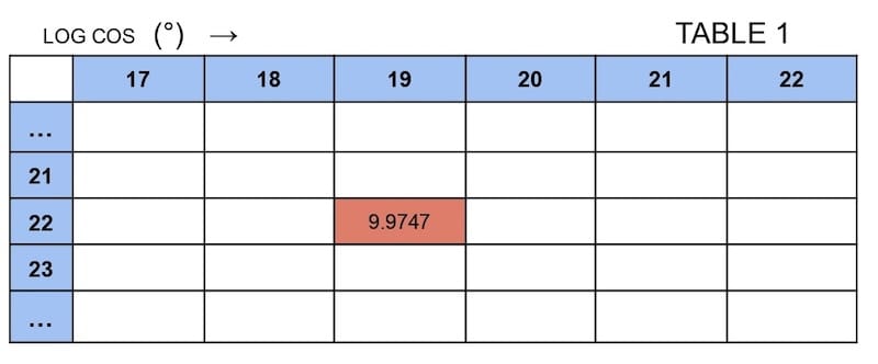
Log cos D = 9.9747
Table 2 (T2)
Log versine P
P = Polar angle = 42° 15′.1
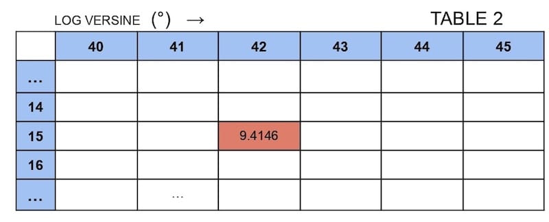
Log versine P = 9.4146
Sun’s altitude and logarithm tables at sea: Table 3
Table 3 (T3)
Cos (L ± D)
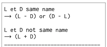
Before finding cos(L ± D), we need to understand the rule called ‘same name / not same name,’ which tells us whether to add or subtract D and L.
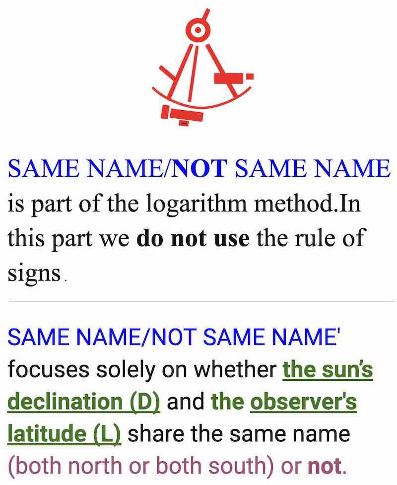
See first: same name/not same name with 4 examples
L = 16°09’N
D = 19°21′.9 S
L and D not same name: ( L+D ) = 16° 09′ + 19°21′.9 = 35° 30′.9
cos (L + D)
( L + D ) = 35° 30′.9
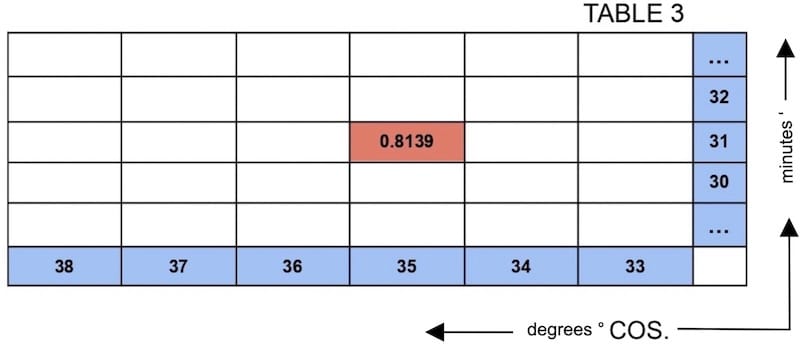
T 3. Cos (35°30′.9) = 0.8139
Log 2nd Term to Nat 2nd Term
Table 4 (T4)
Mantissa: the fractional part of a logarithm.
Characteristic: the integer part of that logarithm.
Firstly, with the Mantissa we will search for the whole number in table 4 (logarithms of whole numbers.)
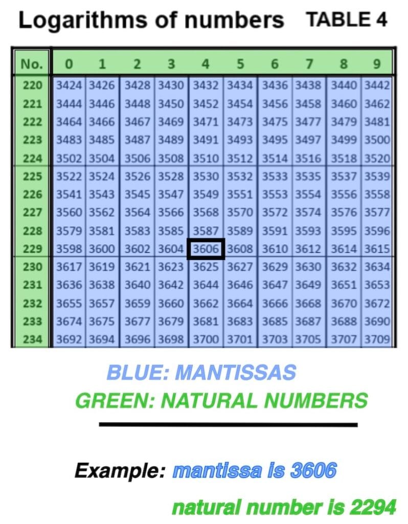
Mantissa = 3718
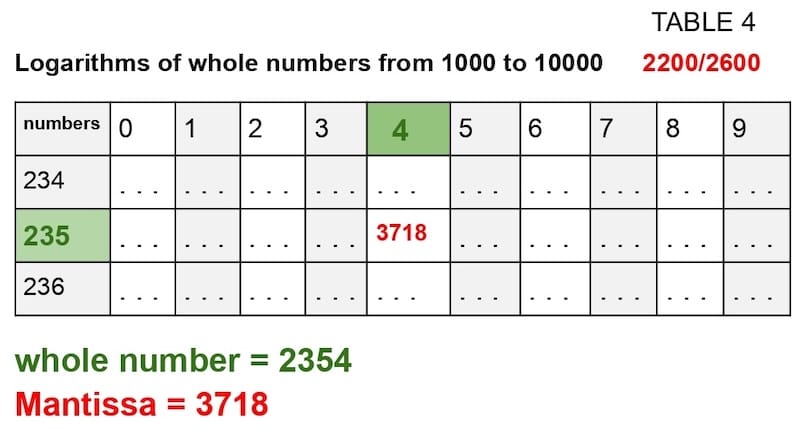
Finally, after finding the whole number 2354, we have to put the decimal point!
With the characteristic 29, we place the decimal point, which gives 0.2354 (see the table below).
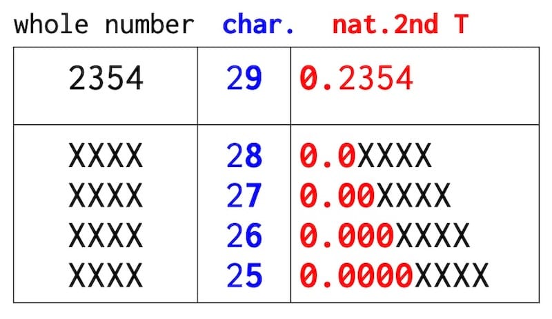
natural 2nd term = 0.2354
Imagine we had obtained a characteristic of 27; then the natural 2nd T would have been 0.002354.
In the method used on EasySextant, the sum of the three logarithmic values always yields a characteristic of 26, 27, 28, or 29.
Natural sine
Table 5 (T5)
Sin Hc = 0.5785
Finally, you have to look up this value ( 0.5785 ) in Table 5 to find the calculated altitude. Sometimes it needs some interpolation.
SIN Hc = 0,57855
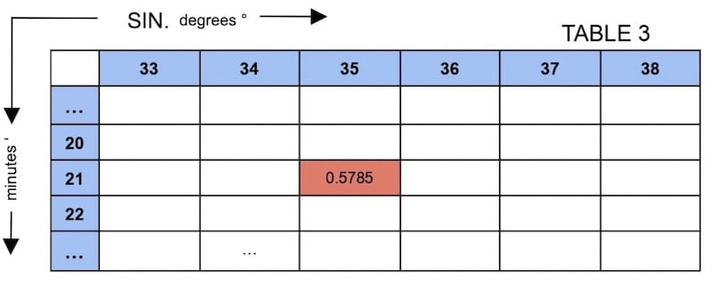
T 5………. Hc = 35° 21′
In fact, with calculator: arcsin (0.5785) = 35° 21′
Seven more exercises with full solutions.

Sun’s altitude and logarithm tables at sea: Brief summary
In celestial navigation, navigators measure the angle between the horizon and the sun with a sextant to obtain the observed altitude.
The calculated altitude is determined from trigonometric formulas using the observer’s dead reckoning position, the sun’s declination, and other relevant parameters.
By comparing the observed altitude with the calculated altitude, navigators can then establish a Line of Position (LOP). This step is essential in celestial navigation, as it refines dead reckoning and provides a reliable method to determine the ship’s position.