
Enjoy exploring this page master sun navigation, BUT ONLY AFTER COMPLETING the foundational La Rochelle exercise.
The main goal of these exercises is to calculate and understand how to calculate the line of position with the sun in daytime.
“La Rochelle” is the first in a series of eight identical exercises, each named after a major city in the world near the simulated sextant observations.
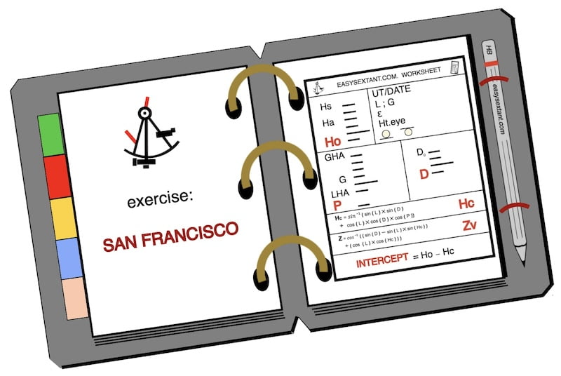
This page focuses on the San Francisco exercise. You can find the others on the Celestial Course page.
While the La Rochelle exercise is for free, the answers for the remaining exercises can be bought in the store.
Master sun navigation:
Before diving into the identical exercise, reflect on the significance of precise Universal Time (UT), as emphasized on this page.
Additionally, engage in the practice of maintaining a watch diary.
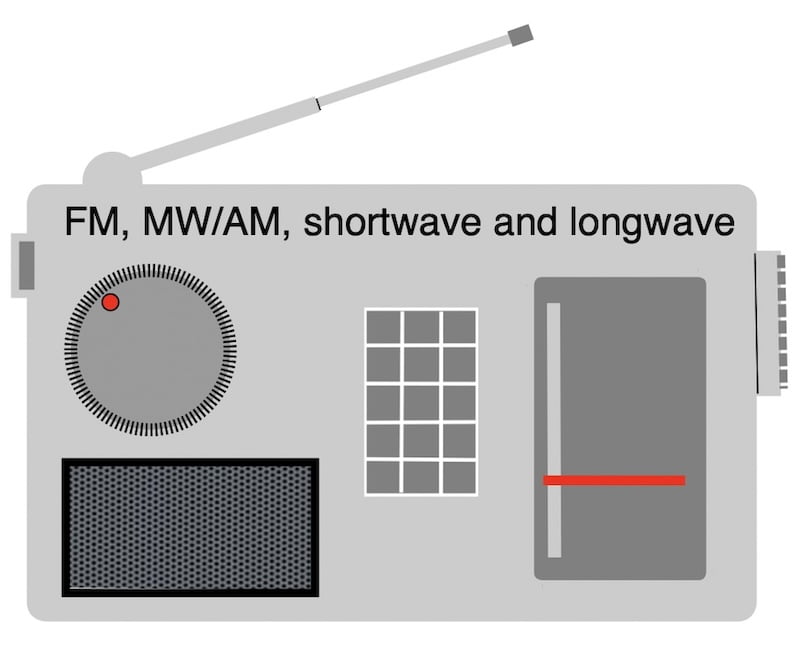
Remember, a small-world radio proves to be a valuable tool onboard for capturing time signals accurately.
Firstly, on this page San Francisco you will find all the sextant sun sight observations required after taking a sun sight at sea off the coast of San Francisco.


print/download PDF worksheet or copy by hand
Master sun navigation:
First part of the sheet of the sun sight observations
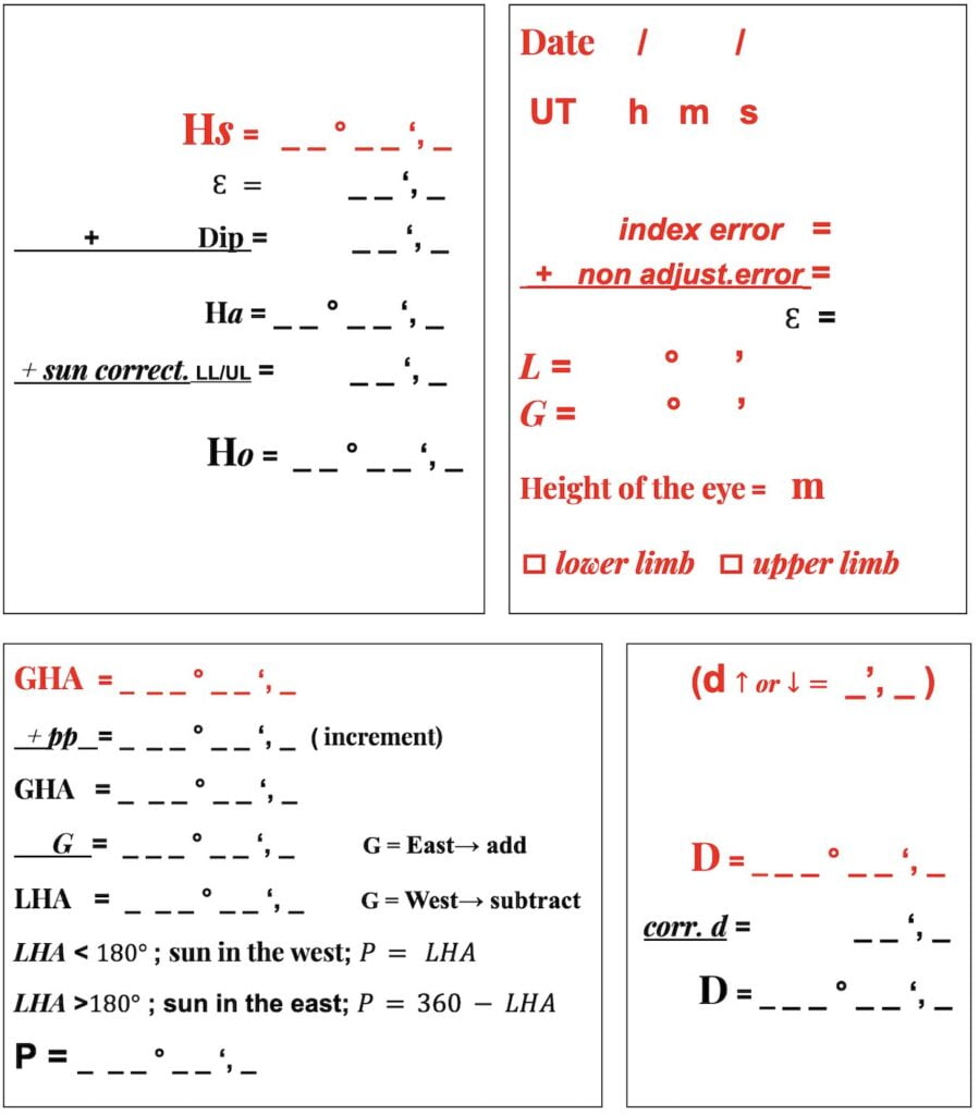
Firstly, start manually completing the red entries on this page.
Master sun navigation:
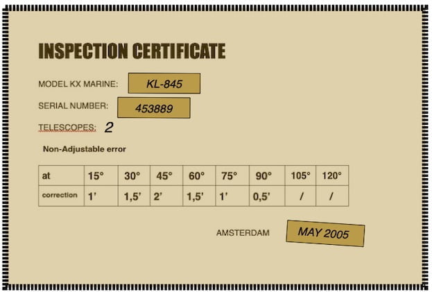
sextant altitude (Hs)
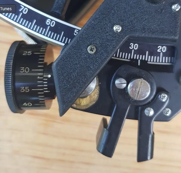
lower limb
Master sun navigation San Francisco:
Time UT and Date

DAY = Thursday; DATE = 06/01/2022; UT Time = 18:34:54
Master sun navigation:

Master sun navigation:
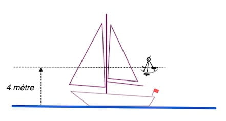
eye height
Master sun navigation:
Latitude L:
34°40′ North
Longitude G:
123°15′ West
daily page
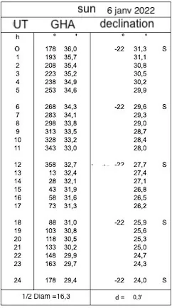
Also this daily page has been downloaded on the nauticalalmanac.it website with the kind permission of its author Capt. Roberto Iori
Master sun navigation:

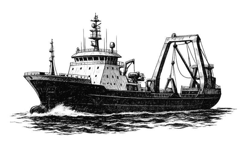
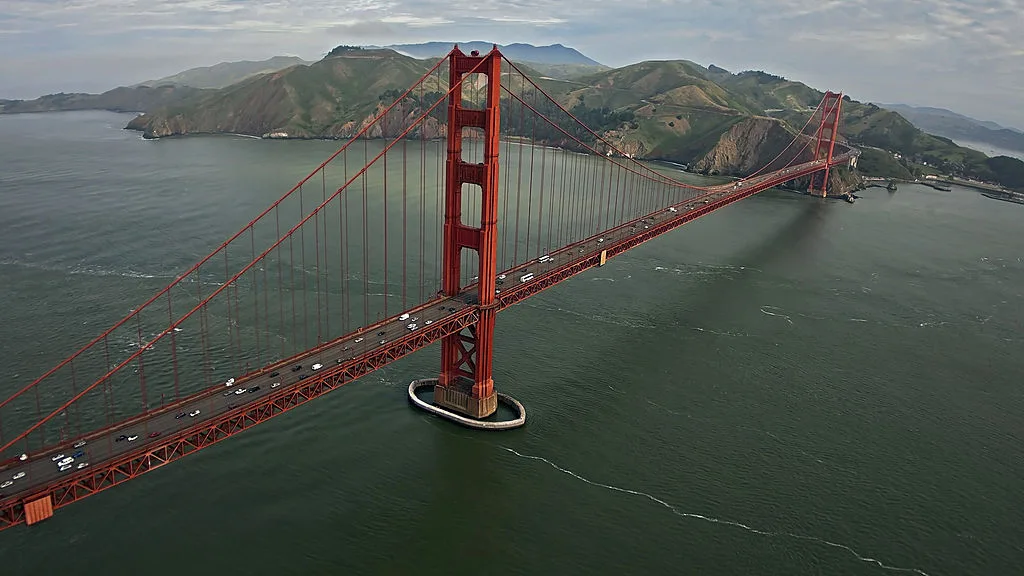
Master sun navigation:The Pacific Ocean off the coast of San Francisco
Firstly, the Pacific Ocean off the coast of San Francisco is a dynamic and ecologically rich marine environment. Known for its diverse marine life and iconic coastal landscapes, this stretch of the Pacific is characterized by upwelling, bringing nutrient-rich waters to the surface and supporting a vibrant ecosystem.
Furthermore, the region is frequented by marine mammals like gray whales and humpback whales, offering excellent opportunities for whale watching. The coastal geology features rugged cliffs and sandy beaches, shaped by tectonic activity and erosion.
Finaly, the ocean’s influence on the climate creates mild and temperate conditions, though coastal fog is common. The California Current plays a role in shaping the currents along the coast.
Residents and visitors alike engage in recreational activities such as sailing, surfing, and fishing, taking advantage of the natural beauty and recreational opportunities provided by the sea off the coast of San Francisco.