

Enjoy exploring this page sun navigation challenges BUT ONLY AFTER COMPLETING the foundational La Rochelle exercise.
Overall, the main goal of these exercises is to calculate and understand how to calculate the line of position with the sun in daytime.
“La Rochelle” is the first in a series of eight identical exercises, each named after a major city in the world near the simulated sextant observations.

This page focuses on the Tokyo exercise and can find the others on the Celestial Course page.
While the La Rochelle exercise is for free, the answers for the remaining exercises can be bought in the store.
Sun navigation challenges:
Keep in mind that when the Latitude aligns with the sun’s Declination, a situation possible in the tropics, the St. Marcq method becomes inapplicable. (see below: design number 5)


Firstly, on this page Tokyo you will find all the sextant sun sight observations required after taking a sun sight at sea off the coast of Tokyo.

Sun navigation challenges:


print/download PDF worksheet or copy by hand
First part of the sheet of the sun sight observations
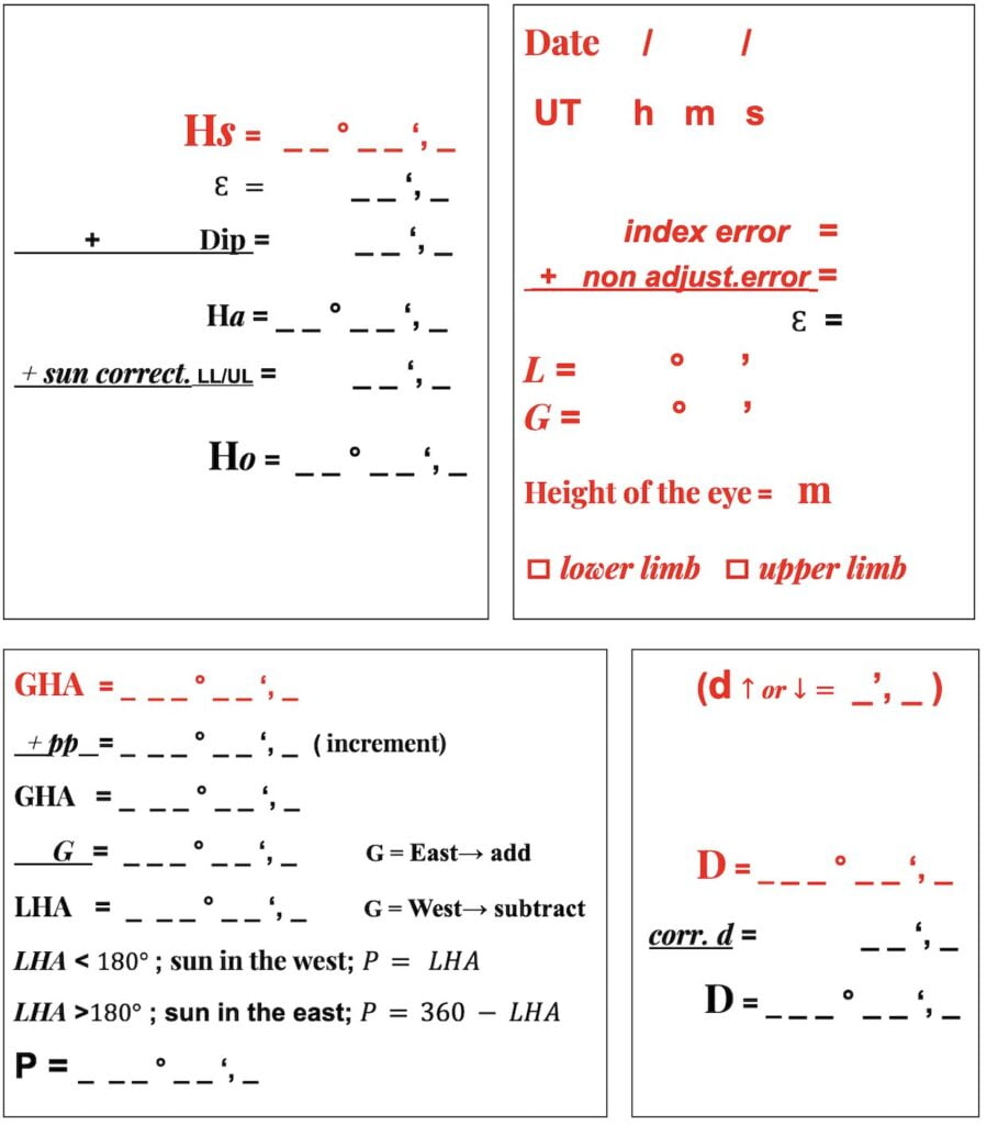
Firstly, start manually completing the red entries on this page.

lower limb
sun navigation challenges Tokyo:
Time UT and Date

DAY = Sunday; DATE = 06/03/2022; UT Time = 20:16:54

Sun navigation challenges:
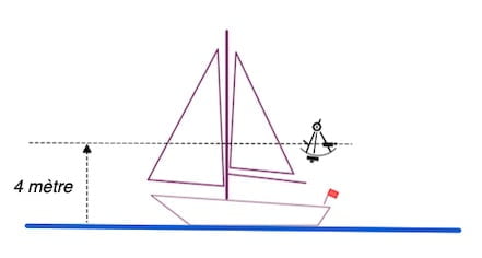
`eye height
Latitude (L) :
33°21′ North
Longitude (G) :
150° 18′ West
daily page

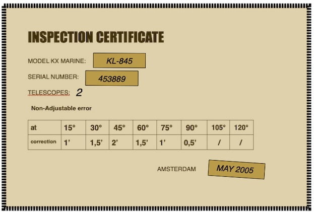
Also this daily page has been downloaded on the nauticalalmanac.it website with the kind permission of its author Capt. Roberto Iori

江戸村のとくぞうsun navigation challenges: the sea east of Tokyo
Indeed, the sea east of Tokyo is the Pacific Ocean, known for its vastness and significance in global maritime trade.
Moreover, it encompasses the Kuroshio Current, a powerful warm current that influences the region’s climate and supports diverse marine life.
Furthermore, the Pacific Ocean has historical importance, having witnessed pivotal events like World War II’s Pacific Theater. Also, Tokyo Bay, situated along the coast, serves as a vital port and plays a crucial role in Japan’s economic activities.
The sea also hosts various recreational activities, such as boating and fishing. While providing valuable resources, the Pacific Ocean faces environmental challenges, including pollution and overfishing.
Overall, the sea east of Tokyo is a dynamic and multifaceted ecosystem, playing a central role in the cultural, economic, and ecological fabric of the region.