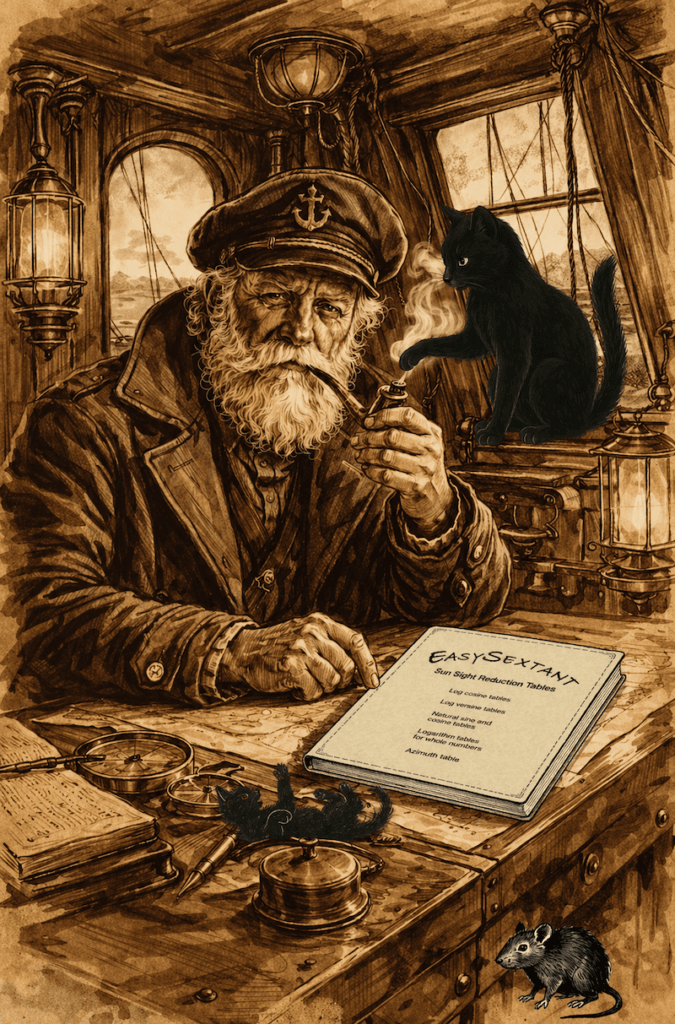
Douwes–Bataille Sun Sight Reduction Tables
Historic Methods for Modern Navigators
Inspired by the work of Cornelis Douwes, an 18th-century Dutch mathematician and navigation scholar whose methods contributed to the development of practical nautical calculations using logarithmic tables, and Louis Bataille, an early 20th-century French master mariner who devised an ingenious tabular method for determining azimuth.
EasySextant brings together these two traditions of celestial navigation in a compact and elegant system, enabling navigators to determine the Sun’s calculated altitude and azimuth without electronic assistance.
Who Should Use These Tables?
Except for students at maritime academies who are required to use specific formulas in their examinations, these tables offer a practical alternative to the American (HO 229 and HO 249) and British (NP 303) sight-reduction tables.
Why Are the EasySextant Reduction Tables So Short?
The use of logarithms is the principal reason why the EasySextant sight-reduction tables can be so short compared with systems based on extensive precomputed tabulations.
Logarithms Were Invented to Make Calculation Easier
“Logarithmetick is a Logical kind of Arithmetick, or artificial use of Numbers invented for the ease of calculation.” — Edmund Gunter, 1623
I have preserved the historical quotation exactly as written.
No Knowledge of Logarithmic Theory Is Required
You do not need to understand the underlying theory of logarithms to use these tables. The only principle you need to know is that, when using logarithms, multiplication is replaced by addition and division by subtraction.
Beyond this simple rule, the necessary skills can be acquired by following the method described on this page.
Eight fully worked examples, together with their solutions, are provided to guide you through the procedure step by step, so that you can quickly become familiar with the method and confident in its practical use.
Faster Than My Programmable Calculator
Although I had learned this method at school as a trainee, I was the proud owner of a programmable calculator and naturally preferred to use it. I soon discovered, however, that experienced officers working with logarithmic tables could complete their calculations far faster than I could with my programmable calculator.
A Practical Alternative to Calculators
These tables are also ideal for anyone who finds scientific calculators cumbersome—especially when complex brackets turn a simple calculation into a frustrating trial-and-error process.
Reliability at Sea
Calculators can age, break, or fail when their batteries run out. EasySextant sight-reduction tables do not. They are reliable, durable, and always ready for use.
The Hidden Simplicity
Four-decimal logarithmic tables are used instead of traditional five-decimal tables. This reduces computational complexity while preserving sufficient accuracy for practical navigation.
Only addition and subtraction are required.
Moreover, these tables are arranged in the logical sequence of the calculation, allowing you to follow the procedure step by step in its natural order.
Clear and Concise Guidance
Each table includes concise explanations—just enough to guide you and refresh your memory whenever needed.
Flexible Editions for the Future
While the daily pages must be replaced each year in your document folder, you can freely choose the edition you need from the available years, ranging from 2026 to 2040.
A Complete, Durable Navigation System
Everything fits neatly into a simple 50-pocket document folder: a complete, durable navigation system you can carry on board for life.
And once again, everything is available to download for free.
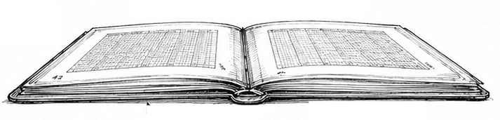
Permanent tables + annual daily pages + 8 worked examples → 84 pages.

Downloads:
Part 1: Permanent Pages
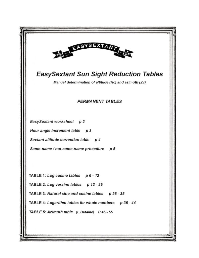
This section contains all the core working tools, including a calculation sheet (grid) for use with logarithmic tables and azimuth, a table for correcting observed Sun altitudes, and five compact tables arranged chronologically.
Part 2: Worked Examples
This section includes eight worked examples based on the same calculation grid. The same method is used each time, with different dates and positions to allow for practice and revision.
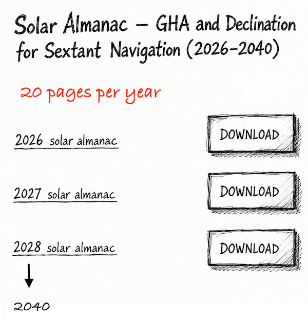
Part 3 : Go to the Solar Almanac page and select the year or years you want to download.
Once you have read the background explanations by Cornelius Douwes and Louis Bataille, continue with:
Example of How to Calculate the Altitude of the Sun (Hc) with the Tables.
Example of How to Calculate the Azimuth of the Sun (Zv) with the Tables.
BACKGROUND
Cornelius Douwes
The celestial navigation method based on logarithms for calculating the Sun’s altitude was not invented by me; it was used for a very long time in the Dutch Navy. This traditional approach allows navigators to determine the Sun’s calculated altitude using only tables and a worksheet — no electronic devices required. This method originates from a logarithmic formula known as Douwes’ formula, after the Dutch mathematician and astronomer Cornelis Douwes (1712–1773).

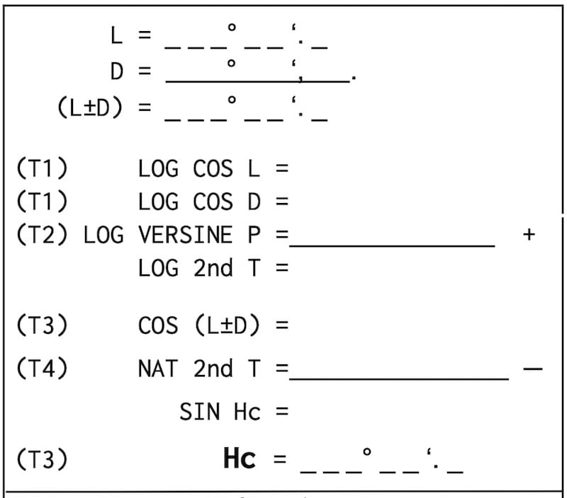
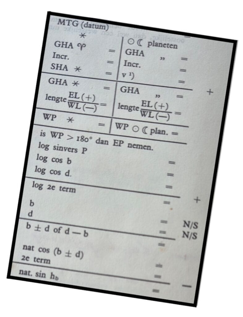
part of the easysextant worksheet
From Nautical Tables to EasySextant
The tables corresponding to this method were originally published together in one book (Zeevaartkundige Tafels — Nautical Tables), along with the worksheet itself. Of these, three are logarithmic. I have edited them separately to make them easier to use in chronological order and more readable.
To meet this objective, I designed a set of 55 pages of permanent tables based on four-decimal values—rather than five—for both trigonometric functions and logarithms. They also include azimuth tables for their calculation.
The Choice of Four-Decimal Tables
The use of four-decimal tables was suggested to me by M. Paul Bedel, the highest-ranking professor and Inspector General of Maritime Education in France, and author of Navigation Tables 1840–1980 (Collection of the Bureau des longitudes, the French equivalent of the British Admiralty). Although highly technical and challenging for practical use, this work is a cornerstone of this type of navigation during that period. (See the link at the bottom of this page.)
This choice intentionally involves a slight loss of precision, but greatly simplifies calculations, reduces the risk of error, and lightens the navigator’s workload.
A Deliberate Compromise in Accuracy
The precision, deliberately adjusted, shifts from one-tenth of a nautical mile to approximately one nautical mile. This is a conscious compromise that prioritizes what matters most: speed, reliability, and efficiency under real navigation conditions.
A Mechanical and Reliable Method
The essential point is to develop a mechanical way of working with these tables. Fill in the worksheet step by step, referring to the tables in sequence, and perform the necessary additions and subtractions to obtain the calculated altitude. The worksheet grid and the tables are available for free download on this page.
Understanding the Logic of Logarithms
The key to understanding this logarithmic method is realizing that it replaces complex multiplications with simple additions. Mastery lies not in the theory of logarithms, but in mechanically filling in the grid and applying the rules of the tables exactly as shown in this menu and its sub-menus.
.

A Complete Navigation System
his publication is neither a traditional almanac nor a bulky collection of institutional tables, but a compact, guided system focused entirely on the Sun’s line of position.
The entire system has been designed for practical onboard use. A simple 50-sleeve document folder is sufficient to carry everything: permanent tables, annual solar data, the calculation grid, and eight worked examples for practice, revision, or refreshing skills after a period without navigation.
Its objective is clear: to reduce mental workload, eliminate the need for a calculator, accept a deliberately “sufficient” level of accuracy, and make celestial navigation more relaxed at sea.
A trained navigator can complete the calculation in about fifteen minutes — and I have witnessed deck officers carrying out six star sights using five-decimal tables, that is, six complete sight reductions, in less than twenty minutes.
Who This Course Is For

As a marine student, I learned to calculate the height of the sun without a calculator.
However, this course, based on the alternative approach using logarithm tables, is less useful for students in merchant marine schools.
France formalized the use of calculators around 1980.
Intended Audience
Primarily aimed at sailors undertaking ocean passages worldwide, this course is intended not only for offshore cruisers, but also for professional sailors delivering vessels across oceans for hire, as well as offshore racers navigating without electronic instruments.

alternative approach based on tables
Efficiency in Practice
With practice, you can become faster with tables than with a calculator.
During my time as a trainee, I completed more than 300 sight calculations with the officers on board.
I almost always used my calculator, while they always used logarithm tables. However, I was never faster than them.
Historical Use in the Dutch Navy
This method with the Douwes formula was used in the Dutch merchant navy from the end of the 18th century until the end of the 20th century
And its worksheet is printed in the Dutch navigation tables “Zeevaartkundige Tafels,” edition 1976 (see part of the worksheet below).
About the Douwes Formula
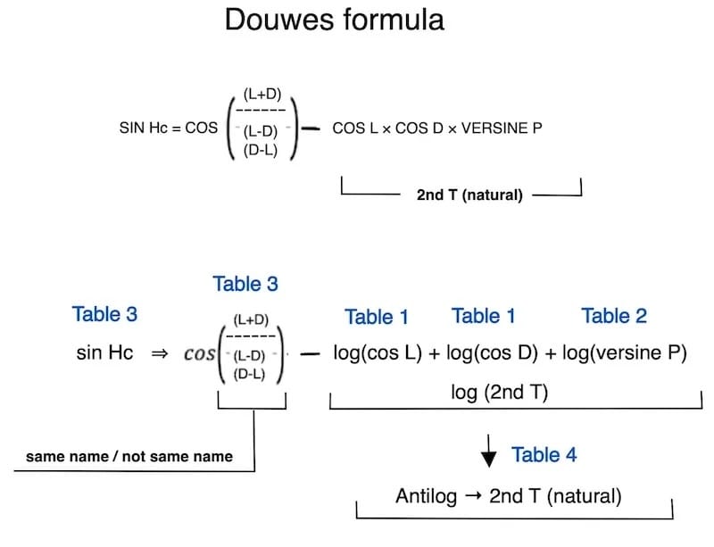
The EasySextant tables that use logarithms are based on the formulas developed by Douwes. Although understanding these complex formulas is not necessary for practical use, a dedicated page has been included to provide background information. Douwes introduced the function known as the versine, which is always positive.
This page offers a simplified explanation of the Douwes formulas and their underlying principles. In practice, all you need to know is how to fill in the worksheet (grid), understand that logarithms replace multiplications with additions and divisions with subtractions, and know how to switch between logarithmic values and natural numbers.

Louis Bataille
Instead of calculating the azimuth with a scientific calculator, you may use the azimuth tables.
Background and Purpose
The tables of Louis Bataille were widely used in France for the teaching and practice of classical celestial navigation. In my own work, their use is limited to the determination of azimuth, based on only about ten pages arranged in two separate tables.
The second table is particularly elegant in its design, as it combines four different arguments. I have recomputed its values and streamlined it for a single purpose: the direct determination of azimuth.
Use in Practice
These tables integrate naturally into a practical navigation routine: using data from the nautical almanac (declination and hour angle), together with the Dead Reckoning position, they provide the azimuth needed to draw the line of position.
Reminder: Easysextant provides Nautical Almanac pages (2026–2040) on this website.
In today’s navigation environment, largely dominated by electronic systems, their use still retains real value. Their simplicity is appealing, and they remain firmly rooted in the tradition of classical navigation, still appreciated by experienced mariners.
Louis Bataille lived mainly during the late 19th and early 20th centuries. Although his name is now rarely mentioned outside specialized circles in the history of astronomy or navigation, he belongs to the tradition of French scholars who contributed to the reliability of nautical calculations. His work reflects the transition between classical navigation and modern methods of position fixing at sea.
The primary focus of our website is to offer guidance on the precise calculation of the Line of Position (LOP).

Azimuth (Zv) or True Azimuth
Azimuth is a mathematical concept used in navigation and surveying to describe the direction of a point relative to a reference direction, typically north.

It is usually measured in degrees, clockwise from north, and ranges from 0° to 360°.
Technical Appendix — L. Bataille Tables
Cotangent formulas
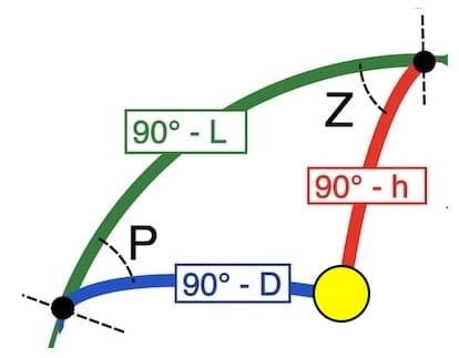
cot Z . sin P = − cos P . sin L ± tan D . cos L
The values m, n and (m+n) in the tables are always positive.
Table 1 → − cos P . sin L = m
m (+) if P > 90°
m (−) if P < 90°
Table 2 → tan D . cos L = n
n (+) if L and D
same name
and n (−) if L and D
not same name
Determination of the azimuth
Table 2 → cot Z . sin P = m + n
Using Table 2 again, with P and (m+n), the azimuth Z is obtained.
The value of Z lies between 0° and 90° (quadrantal angle).
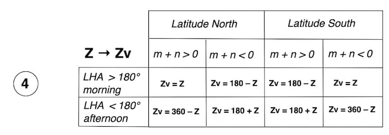
The true azimuth Zv is then determined.
The Ingenuity of the Bataille Tables
L. Bataille achieves a true masterstroke by designing a method in which the same central values of Table 2 are reused successively. After the two entries in Table 1 (P and L) used to obtain , then the two entries in Table 2 (D and L) giving , this same Table 2 is immediately reused with P and to obtain the azimuth Z directly.
I found the name Douwes thanks to M Paul Bedel
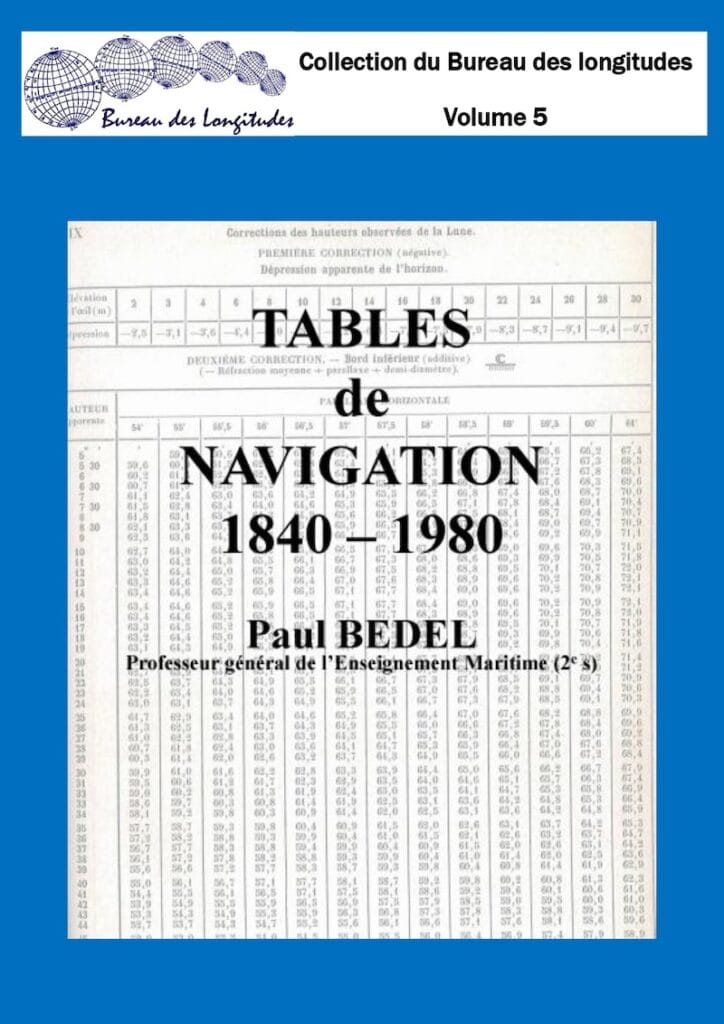
He wrote an incredible book “navigation tables 1840-1980” Collection of the Bureau des longitudes.
The author, M Paul Bedel, is a professor and inspector general of maritime education in France.
The work in French, in pdf format (volume 5):
This collection, published by the Bureau des Longitudes, aims to disseminate various documents related to the Bureau’s fields of expertise which, for various reasons, have not been the subject of commercial publication, but whose distribution is considered appropriate.
